Your Cart is Empty


Top 5 Features of RhinoTerrain for Enhanced Topographical Modeling in Design and Engineering
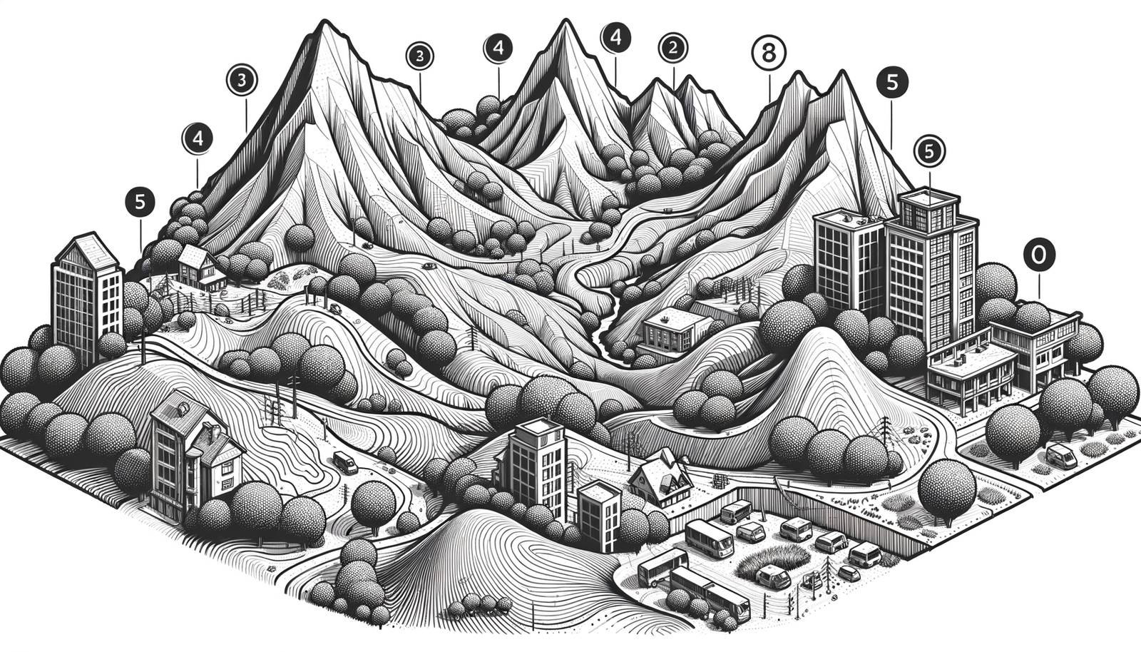


In the fields of design, engineering, and architecture, accurate topographical modeling is more than just a representation of the Earth's surface—it's a critical component that influences the feasibility, functionality, and sustainability of projects. Whether it's urban planning, infrastructure development, or environmental conservation, understanding the terrain allows professionals to tailor their designs to the unique characteristics of the landscape. However, creating detailed and precise terrain models has traditionally been a complex and time-consuming process, often hindered by limitations in software capabilities.
Enter RhinoTerrain, a specialized plugin for Rhinoceros 3D (Rhino), one of the industry's most versatile 3D modeling platforms. RhinoTerrain enhances Rhino's native functionalities by introducing advanced tools specifically designed for topographical modeling. This powerful combination empowers users to handle complex terrain data efficiently and accurately, bridging the gap between raw geographical information and practical design applications.
In this article, we will delve into the top five features of RhinoTerrain that elevate topographical modeling, demonstrating how this plugin can transform your workflow and enhance the quality of your projects.
Advanced Digital Terrain Modeling (DTM)
At the heart of RhinoTerrain lies its ability to create high-precision terrain models from a variety of data sources. Whether you're dealing with large-scale landscapes or intricate site details, RhinoTerrain provides the tools necessary to generate accurate representations of the terrain.
Handling Diverse Data Sources
RhinoTerrain supports the import and processing of extensive datasets, including:
- Point Clouds: Capture millions of data points representing the terrain's surface, often obtained from photogrammetry or laser scanning techniques.
- LiDAR Data: Utilize Light Detection and Ranging (LiDAR) data to create detailed models of the Earth's surface, including vegetation and built structures.
- ASCII Files: Import elevation data stored in ASCII format, commonly used for sharing geographic information.
By accommodating these varied data sources, RhinoTerrain ensures that users can work with the most suitable and available data for their specific projects.
Efficient Handling of Large Datasets
One of the challenges in terrain modeling is managing large datasets without compromising performance. RhinoTerrain is optimized to handle extensive data efficiently, allowing for smooth navigation and manipulation within the modeling environment. This capability is particularly beneficial for projects involving vast geographical areas or highly detailed terrain features.
Generation of Triangulated Irregular Networks (TIN)
A key feature of RhinoTerrain's DTM capabilities is the ability to generate Triangulated Irregular Networks (TIN). TINs are crucial for representing complex terrains because they adaptively adjust the size and shape of triangles to accurately depict variations in the landscape. Unlike regular grid models, TINs can capture sharp edges, cliffs, and other irregular features with higher fidelity.
By leveraging TINs, users can create terrain models that faithfully represent the nuances of the actual terrain, providing a solid foundation for subsequent analysis and design work.
Seamless Integration with GIS Data
Integrating spatial data is essential for adding context to terrain models. RhinoTerrain excels in this area by offering seamless compatibility with Geographic Information Systems (GIS).
Support for Common GIS Formats
RhinoTerrain supports importing and exporting data in widely used GIS formats, including:
- Shapefiles: Import vector data representing features such as roads, boundaries, and water bodies.
- Digital Elevation Models (DEMs): Incorporate raster-based elevation data to enhance the terrain model.
This compatibility ensures that users can easily incorporate existing GIS data into their models, enriching them with valuable geographic information.
Coordinate Systems and Georeferencing
Proper alignment of spatial data is critical. RhinoTerrain allows users to manage coordinate systems and georeferencing directly within Rhino. Users can specify the coordinate system for their project, ensuring that all imported data aligns correctly. This feature eliminates the need for external software to handle coordinate transformations, streamlining the workflow.
Overlaying GIS Data onto Terrain Models
By overlaying GIS data onto terrain models, users can enhance their projects with contextual information. For example:
- Urban Planning: Incorporate zoning boundaries, utility lines, and transportation networks to assess project impacts.
- Environmental Analysis: Overlay vegetation maps, wildlife habitats, or flood zones to evaluate environmental considerations.
- Infrastructure Development: Integrate existing infrastructure data to plan new developments harmoniously with the current landscape.
This integration allows for a holistic approach to design and analysis, considering both the physical terrain and the socio-environmental context.
Automatic Contour Line Generation
Contour lines are essential for visualizing elevation changes and understanding the shape of the terrain. RhinoTerrain simplifies the creation of contour lines with its automatic generation feature.
Customizable Contour Intervals
Users can define contour intervals based on the specific needs of their project. Whether you require detailed contours at every 0.5 meters for a small site or broader intervals for a regional overview, RhinoTerrain provides the flexibility to customize intervals accordingly.
Adjustable Contour Settings
RhinoTerrain offers extensive options to tailor the appearance and functionality of contour lines:
- Line Styles and Weights: Customize line styles (solid, dashed, dotted) and weights to differentiate between major and minor contours or to adhere to organizational standards.
- Elevation Labeling: Automatically label contours with elevation values, making it easier to interpret the terrain at a glance. Labels can be formatted to match specific styling requirements.
- Smoothness and Accuracy: Control the balance between smooth contour lines and precise adherence to the underlying terrain data. This allows users to generate aesthetically pleasing contours without sacrificing accuracy.
Exporting and Sharing Contour Data
Generated contour lines can be exported in various formats compatible with other CAD and GIS applications. This feature facilitates collaboration with other professionals, such as civil engineers or surveyors, who may require contour data for their analyses.
Terrain Analysis Tools
For deeper insights into the terrain, RhinoTerrain provides a suite of analysis tools that help users understand the physical characteristics of the landscape.
Slope Analysis
Slope analysis is crucial for:
- Assessing Buildability: Identifying areas suitable for construction based on slope constraints.
- Erosion Control: Recognizing steep areas prone to erosion and implementing mitigation strategies.
- Accessibility Planning: Designing roads, pathways, and ramps that comply with slope-related regulations.
RhinoTerrain allows users to generate slope maps that visualize gradient variations across the terrain, using color coding to represent different slope ranges.
Aspect Analysis
Aspect analysis determines the direction each part of the terrain faces, which is important for:
- Solar Exposure: Planning the orientation of buildings to maximize natural lighting and solar gain.
- Vegetation Growth: Understanding microclimates affecting plant selection and landscaping.
- Wind Patterns: Analyzing how terrain orientation influences wind flow for ventilation or windbreak planning.
By visualizing aspect data, users can make informed decisions that enhance the sustainability and comfort of their designs.
Elevation Profiling and Cross-Sectional Views
Creating elevation profiles along specific paths allows for:
- Infrastructure Design: Planning roads, pipelines, or railways with an understanding of elevation changes.
- Earthworks Estimation: Calculating cut and fill volumes for excavation and grading.
- Landscape Visualization: Presenting cross-sections to stakeholders to communicate terrain-related challenges and solutions.
RhinoTerrain enables users to generate precise profiles and cross-sections, providing critical data for project planning.
Visualization Tools
To aid in interpreting analysis results, RhinoTerrain includes visualization tools such as:
- Heat Maps: Represent data like slope or elevation with color gradients, making patterns easily identifiable.
- Color Gradations: Apply graduated colors to the terrain model based on analysis results, enhancing visual communication.
These tools help convey complex data in a clear and accessible manner, facilitating better decision-making.
Advanced Editing and Manipulation Capabilities
Modifying terrain models to reflect proposed changes is a vital part of the design process. RhinoTerrain equips users with advanced tools to edit and manipulate terrains accurately.
Cutting, Filling, and Grading Operations
Simulate earthworks by:
- Cutting: Remove portions of the terrain to accommodate structures like basements, underground parking, or tunnels.
- Filling: Add material to raise the terrain, create embankments, or level uneven areas.
- Grading: Adjust slopes to meet specific design criteria, improve drainage, or prepare sites for construction.
These operations enable designers to model the impact of their proposals on the existing terrain, ensuring that designs are practical and compliant with regulations.
Simulating Earthworks and Landscaping Changes
RhinoTerrain allows users to model landscape modifications such as:
- Retaining Walls: Design walls that hold back soil in steep areas, integrating them into the terrain model.
- Terracing: Create stepped levels on sloped sites for gardens, seating areas, or agricultural purposes.
- Artificial Water Features: Incorporate ponds, lakes, or drainage systems into the terrain.
By visualizing these elements within the terrain model, designers can assess aesthetic and functional aspects before implementation.
Integration with Other Rhino Plugins and Commands
RhinoTerrain seamlessly integrates with other Rhino plugins and commands, expanding its capabilities. For instance:
- Grasshopper Integration: Use parametric design tools to automate and optimize terrain modifications.
- Architecture Modeling: Combine terrain models with building designs for comprehensive site planning.
- Rendering and Visualization: Produce realistic renderings that include accurate terrain representations.
This interoperability ensures that the terrain model remains consistent across different aspects of the project, enhancing efficiency and reducing errors.
Dynamic Updates Based on Design Changes
As projects evolve, design changes are inevitable. RhinoTerrain's ability to dynamically update terrain models ensures that any modifications are reflected across the entire model. This feature:
- Maintains Consistency: Automatically adjusts related elements when changes are made, reducing the risk of discrepancies.
- Saves Time: Eliminates the need for manual updates, streamlining the workflow.
- Enhances Collaboration: Facilitates coordination among team members by keeping everyone updated with the latest model.
Conclusion
In an industry where precision and efficiency are paramount, RhinoTerrain offers a powerful solution for topographical modeling. Its advanced features transform how professionals interact with terrain data, providing tools that not only enhance accuracy but also promote creative exploration. From generating high-fidelity terrain models and integrating GIS data to performing detailed analyses and manipulating the landscape, RhinoTerrain equips users with capabilities that significantly improve project outcomes.
By embracing RhinoTerrain, designers, engineers, and architects can unlock new possibilities in their work. The plugin's ability to handle complex tasks with ease allows professionals to focus on innovation and problem-solving rather than technical limitations. As the demands of projects continue to evolve, leveraging the full potential of RhinoTerrain becomes not just an advantage but a necessity in delivering exceptional results.
Also in Design News