Your Cart is Empty
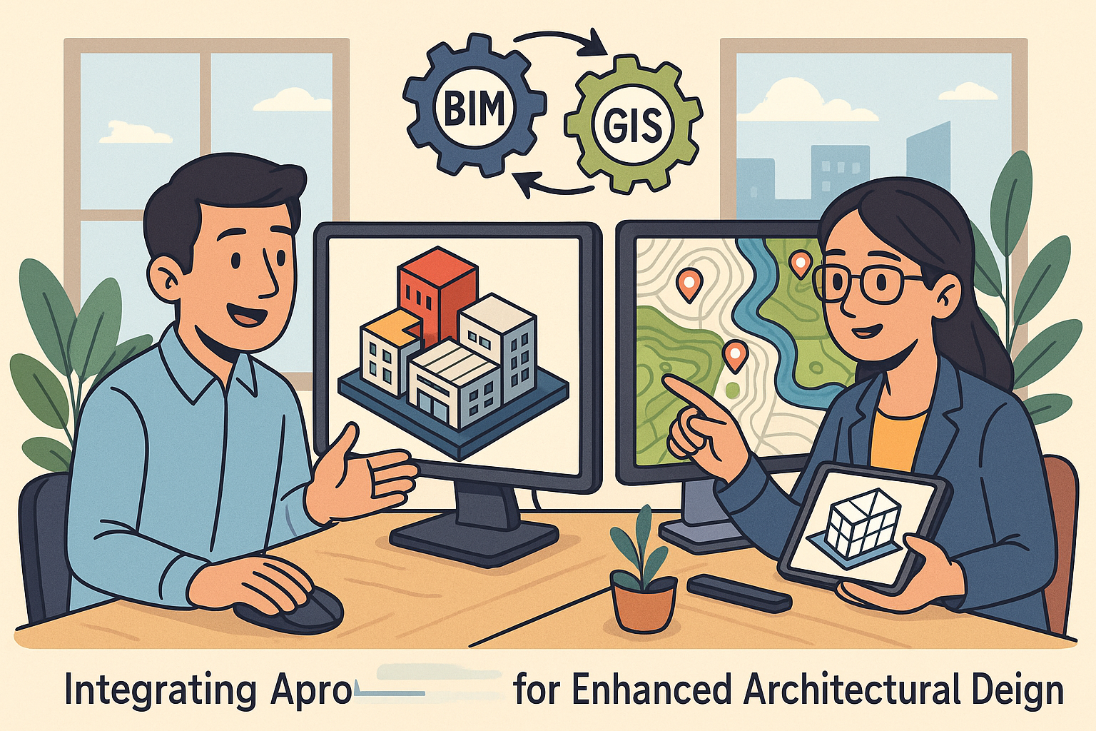
Integrating BIM and GIS for Enhanced Architectural Design and Planning


Defining BIM and GIS in the Architectural Context
The integration of **Building Information Modeling (BIM)** and **Geographic Information Systems (GIS)** in the architectural discipline has gradually emerged as a transformative approach in the design, construction, and planning processes. BIM provides a detailed digital representation of physical and functional characteristics of a facility. It operates as a shared knowledge resource for information about a facility, forming a reliable basis for decisions during its life-cycle from inception onward. This method utilizes precise digital models that reflect various architectural elements, materials, and components, ensuring that every phase of design and construction is accurately informed by rich data. Concurrently, GIS specializes in managing, analyzing, and visualizing spatial and environmental information, thus enabling the analysis of locational data that is critical for urban planning and environmental assessments. The architectural context benefits from the malleability of BIM's intricate modeling capabilities combined with the spatial and geostatistical power of GIS. In practice, this integration serves to elevate design decision-making by unifying internal building data with external geographic context.
Overview of Building Information Modeling (BIM)
BIM is an advanced digital modeling process that supports a wide range of functions crucial in design and construction management. It introduces a paradigm where the entire lifecycle of building infrastructure is digitally represented, leading to improvements across cost estimation, time management, and collaborative communications. The core functions of BIM include generating accurate digital schematics, simulating construction sequences, and facilitating project coordination across interdisciplinary teams. Key functions in design and construction management include the ability to produce highly detailed 3D models that are augmented with metadata about every design element. These models provide stakeholders with an immersive and detailed view of a project before construction begins, reducing errors, conflicts, and misinterpretations significantly. BIM also plays an essential role in monitoring the performance of constructed environments, thereby supporting detailed building performance insights, which help in improving energy efficiency and sustainability over a facility's life cycle.
Key Functions and Performance Insights in BIM
The robust nature of BIM creates a framework whereby every design detail is documented and accessible. This level of detail includes information about the materials, spatial relationships, geographic information, and the physical properties of building components, ensuring a holistic view of any architectural project. The capabilities of BIM enhance decision-making during the design phase by enabling simulation of construction processes and optimizations that would otherwise require extensive trial-and-error methods. Some of the key functions include:
- Precise geometric modeling that accurately captures the physical layout and dimensions of a prospective building.
- Metadata integration which attaches critical information such as material specifications and energy models to each building component.
- Collaborative platforms that support synchronous editing and real-time feedback among multi-disciplinary teams.
Overview of Geographic Information Systems (GIS)
GIS stands as a cornerstone in modern spatial and environmental analysis. As a systematic framework for gathering, analyzing, and visualizing geographic data, GIS plays an instrumental role in urban and regional planning. It provides external context that is essential to understanding how a building interacts with its surrounding environment and infrastructure. At its core, GIS helps designers interpret and manage information about physical spaces, including terrain features, demographic distributions, and environmental parameters that influence not only construction but also long-term sustainability. The integration of GIS into architectural workflows supports decision-making that is informed by extensive spatial data, ensuring projects are not insular but rather fully integrated into existing environmental and community frameworks. Planners, architects, and engineers rely heavily on GIS to visualize and analyze how their projects will fit within broader geographic contexts, thereby minimizing discrepancies between the physical world and digital models.
Role of GIS in Spatial and Environmental Analysis
The emphasis on geographic data through GIS provides a multi-layered perspective of physical environments. GIS tools offer capabilities that allow professionals to integrate a variety of data layers, which include land use patterns, topographical features, and even climatic data. Such detailed geographic information is invaluable when assessing risks such as flood prevalence, soil stability, and environmental impacts stemming from new construction projects. The spatial analytical power of GIS is underpinned by its ability to:
- Map complex geographies using high-resolution satellite imagery and digital elevation models.
- Analyze spatial relationships by discerning patterns and correlations between different types of environmental data.
- Plan infrastructure strategically by integrating network analysis that considers transportation, utilities, and emergency services.
The Convergence of BIM and GIS
The historical evolution of integrating BIM and GIS has marked a significant shift in how architectural and urban planning projects are conceived and executed. The convergence of these two methodologies has its origins in the need to bridge the gap between detailed building modeling and expansive geographic analysis. With the integration of **3D building models** and geospatial data, architects and planners are now empowered to design structures that are sensitive to both the intricacies of a building's internal systems and their interaction with the external environment. This unified approach has been instrumental in promoting enhanced decision-making and elevating design precision, where context no longer remains an adjunct but becomes a core aspect of the design process. The melding of BIM and GIS fosters an environment in which both disciplines influence each other, resulting in a platform that supports both micro and macro-level planning.
Historical Context and Evolution
Historically, BIM and GIS operated in silos with specialized applications. BIM was predominantly used for detailed architectural designs, while GIS focused on regional planning and the broader environmental context. As technological advancements progressed, the need for a more integrated approach became evident. Today, the amalgamation of both domains is not only feasible but also highly advantageous. This evolution reflects in the standardization of data exchange protocols, such as the Industry Foundation Classes (IFC) for BIM and CityGML for GIS, which have laid the groundwork for seamless interoperability. The integration has allowed professionals to:
- Merge detailed design models with geographic data to simulate real-world scenarios.
- Optimize infrastructure planning by aligning assets with spatial trends.
- Facilitate efficient project collaboration by providing a single source of truth that bridges design and planning.
Relevance of Merging 3D Building Models with Geospatial Analysis
The integration of BIM and GIS further underscores the importance of merging detailed 3D building representations with expansive geospatial analysis. This synergy has redefined the planning paradigm by providing a more articulate narrative of how buildings coexist with their environment. Such a synthesis facilitates a deep understanding of environmental constraints, where spatial data informs decisions about sunlight exposure, prevailing winds, and terrain stability. Moreover, it enhances the technical aspects of simulation and visualization, ensuring that designs are both efficient and aligned with sustainability imperatives. Professionals can now leverage integrated data to evaluate multiple design scenarios, all while considering ecological impacts, urban density, and infrastructural connectivity. By deploying integrative technologies, the traditional silos that once separated building design from site planning are dissolved, thereby instituting a more harmonious and data-driven approach to architecture. This merger not only augments the technical capabilities of both systems but also instills a strategic vision that is both comprehensive and forward-thinking.
Key Benefits of Integrating BIM and GIS
The marriage of BIM and GIS creates a transformative platform that significantly enhances the architectural workflow. By integrating the precise digital modeling capabilities of BIM with the expansive environmental and spatial analysis offered by GIS, design professionals have access to a consolidated body of information. This integration allows for rigorous contextual analysis and fundamentally improves design accuracy. The optimized approach transcends traditional practices by ensuring that every project is informed by detailed spatial data, leading to design decisions that are both efficient and environmentally sensitive. In addition to enhancing accuracy, the integration of these two systems facilitates improved resource management and planning. The workflows become increasingly streamlined through the seamless transfer of data between BIM and GIS tools, which enhances overall collaboration and reduces redundant processes. As a result, projects can proceed with better-coordinated input from architects, urban planners, and environmental engineers, all working from a unified dataset.
Enhanced Design Accuracy and Contextual Analysis
Integrating BIM and GIS has been instrumental in improving design accuracy through the development of a robust, location-based decision-making framework. With a clear view of the surrounding context, key design decisions—from building orientation to site layout—can be optimized to reflect environmental conditions and infrastructural constraints. This approach ensures that building plans are optimized not only for usability but also for long-term sustainability. The benefits are reflected in:
- Improved location-based decision making by harnessing accurate geospatial data to tailor designs to site-specific conditions.
- Enhanced contextual analysis that aligns environmental, infrastructural, and demographic factors with design strategies.
- Reduced design errors due to dependable, integrated data streams that eliminate inconsistencies.
Optimized Planning and Resource Management
One of the most significant advantages of fusing BIM and GIS is the optimization of planning processes and resource management. By streamlining workflows that traditionally relied on isolated datasets, professionals can now harness the power of a unified database. This convergence facilitates enhanced collaboration between various stakeholders, ensuring that every project phase from initial design to construction execution is thoroughly supported by accurate and up-to-date information. The integrated approach allows for:
- Streamlined workflows that reduce time and costs associated with data redundancy and rework.
- Efficient resource allocation by enabling precise planning based on a comprehensive analysis of environmental and infrastructural data.
- Enhanced stakeholder collaboration through the sharing of centralized and coherent datasets.
Improved Risk Assessment and Sustainability Analysis
The integration of BIM and GIS provides architects with a powerful tool for risk assessment and sustainability analysis. By unifying detailed building models with comprehensive spatial data, design professionals can identify potential environmental or logistical challenges long before construction begins. This proactive approach enables early detection of issues such as site instability, flood-prone areas, or energy inefficiencies. The resulting benefit is a more resilient design that accommodates risk mitigation from the earliest planning stages. Specific benefits include:
- Enhanced risk management capabilities that allow for the early identification and analysis of environmental challenges.
- Improved sustainability analysis that ensures designs are environmentally responsible and energy-efficient.
- Informed decision-making by correlating environmental data with design parameters to preemptively address potential issues.
Tools, Technologies, and Methodologies
Advancements in software platforms and integrative methodologies have been key drivers in the successful integration of **BIM** and **GIS**. As the digital landscape evolves, numerous specialized tools and robust interoperability standards have emerged to facilitate seamless data flow between these systems. These technologies empower architects, urban planners, and engineers to not only design with precision but also to collaborate more effectively across multiple disciplines. In addition to traditional design tools, modern computing methods now include cloud-based collaborative platforms, real-time data updates, and standards that harmonize data exchange. This evolution has given rise to an integrated ecosystem where iterative updates to BIM models are synchronized with extensive geospatial datasets managed by GIS platforms. The process has consequently been enhanced through the adoption of best practices and workflows that embrace both digital and spatial considerations.
Software Platforms and Interoperability Standards
Leading the charge in this integrated environment are software platforms that are specifically designed to bridge the gap between BIM and GIS capabilities. These systems are equipped with industry-standard data exchange protocols such as IFC for BIM and CityGML for GIS to ensure compatibility and accuracy. This robust foundation promotes reliable interoperability, making it feasible for teams to work on highly complex projects without the friction of incompatible data formats. Key functionalities in these platforms include:
- Seamless data exchange through adherence to established interoperability standards.
- Robust visualization tools that merge 3D models with geospatial overlays for comprehensive analysis.
- Real-time collaboration supported by cloud services and synchronized update mechanisms.
Integrative Workflows and Best Practices
The success of integrating BIM with GIS heavily relies on establishing integrative workflows that facilitate seamless communication across systems. This implies careful setting up of a unified database that continuously aggregates updates from both BIM models and GIS platforms, ensuring that the entire project team has access to the most current data. Best practices include:
- Standardization of data formats across different software to prevent errors during data translation.
- Routine synchronization of updates between BIM and GIS models using automated or semi-automated processes.
- Cross-disciplinary collaboration protocols which ensure that each stakeholder understands how data modifications impact the broader project framework.
Challenges, Opportunities, and Future Trends
While the convergence of BIM and GIS offers substantial benefits, it also presents a range of challenges that organizations must overcome. These hurdles include data fragmentation, inconsistent standards, and a cultural resistance to transitioning from traditional workflows to digitally integrated solutions. Despite these barriers, the opportunities for improvement and innovation remain significant. The integration of these advanced technologies requires a coordinated effort to standardize data formats, which in turn fosters a more cohesive environment for collaboration. Enhanced training programs and improved communication between departments are essential components of successful implementation. As companies invest in technological infrastructure, the promise of smarter, more sustainable design and planning practices becomes increasingly attainable. This commitment to adopting a unified approach not only minimizes risk but also unlocks new possibilities that enhance modern architectural workflows.
Identifying Current Barriers
One of the primary challenges in the integration of BIM and GIS is the issue of data fragmentation. In many organizations, data is stored in disparate systems, leading to difficulties in establishing a unified database. Inconsistent data formats and technological interoperability issues further complicate the seamless exchange of valuable information between BIM and GIS platforms. Challenges in achieving this integration include:
- Data fragmentation due to isolated storage systems and legacy software incompatibilities.
- Inconsistent standards that lead to errors when merging information from different sources.
- Cultural and organizational challenges whereby traditional workflows resist the adoption of integrated digital solutions.
Strategies for Overcoming Implementation Challenges and Future Directions
To successfully navigate the barriers associated with BIM and GIS integration, organizations must adopt a multi-faceted strategy. This includes the standardization of data formats, development of collaborative platforms, and investment in comprehensive training programs for staff. Embracing advanced tools like AI and machine learning to automate routine tasks is emerging as a promising pathway. These innovative technologies are set to enhance not only the efficiency of data exchange but also the predictive accuracy in simulations and forecasts. Key strategies for overcoming these challenges include:
- Standardization of data formats to ensure consistency and reduce integration errors.
- Implementation of collaborative platforms that promote real-time data sharing and communication among stakeholders.
- Investment in training and change management to prepare teams for the transition to integrative workflows.
Conclusion
The integration of **BIM** and **GIS** represents a significant technological leap for the architectural industry. By merging high-fidelity digital models with comprehensive spatial analysis, design professionals are equipped to produce more precise, efficient, and sustainable projects. This unified approach not only enhances decision-making processes but also supports early risk assessment, effective resource management, and continuous improvement across project lifecycles. As architectural practices evolve, the adoption of advanced technologies and integrated workflows will continue to shape the future of design, leading to smarter cities and more resilient built environments.
Recap and Final Thoughts
Embracing the integration of BIM and GIS is not simply about adopting new software—it's about pioneering a transformative methodology that reshapes every stage of design and planning. Through enhanced accuracy, contextual analysis, and seamless data connectivity, professionals are better equipped to meet the challenges of modern urban development. The shift towards a unified digital ecosystem ensures that designs are not only cutting-edge but also inherently sustainable and adaptable to future trends. By prioritizing continuous innovation and collaboration, firms can achieve a higher standard of excellence, setting the stage for a future where technology and design coexist to deliver projects that are as resilient as they are visionary.
Also in Design News