Your Cart is Empty
Design Software History: Evolution of Geospatial Data Integration in Design Software: Historical Milestones, Technological Breakthroughs, and Future Trends


Introduction and Context: Defining Geospatial Data and Its Relevance
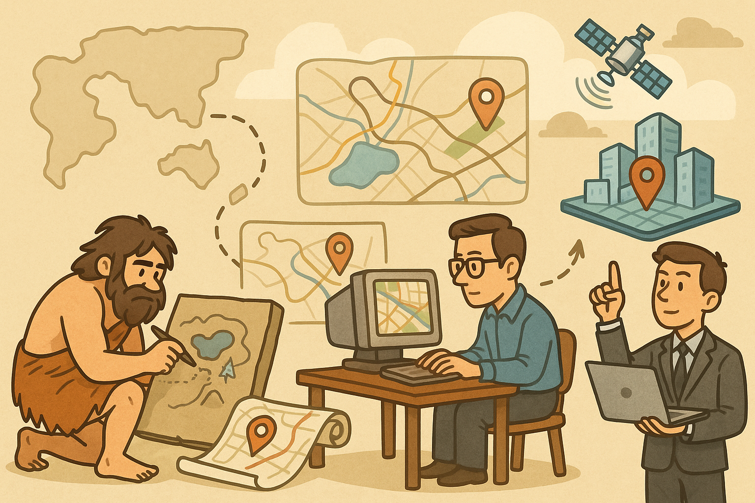
In the realm of design software, geospatial data has evolved from a niche element used in specialized mapping systems to a core component integral to modern design processes. Geospatial data, broadly defined as information documented with geographic coordinates and properties, plays an increasingly vital role in the design software ecosystem by enabling precise location-based insights and modeling capabilities. Over the last several decades, design software developers have methodically integrated spatial intelligence, recognizing that effective visualization of geographic features enhances user decision-making and promotes transparency in planning, simulation, and execution. The profound integration of geospatial data not only amplifies functionality but also revolutionizes industries such as urban planning, infrastructure design, engineering computations, and product visualization by providing a concrete understanding of location-centric dynamics.
Historical Background and the Emergence of Spatial Intelligence
The historical context that set the stage for geospatial integrations in design technologies is both rich and multifaceted. Initially, design software applications were heavily focused on drafting and static visualization, offering limited, if any, geographical context to designs. As industries began to demand more detailed environmental analyses for projects ranging from civil engineering to architectural construction, companies like Autodesk and Bentley Systems gradually recognized the need to embed geospatial capabilities. Early mapping systems, constrained by rudimentary database technology and manual data entry procedures, soon gave way to automated spatial intelligence through innovations in geographic information systems (GIS). The evolution of these systems facilitated an era where spatial data was no longer an add-on but a critical ingredient in the design process. Developers and engineers began leveraging evolving data infrastructures to integrate mapping and location-based modeling directly into design workflows, thereby broadening the scope of functionalities available in these platforms.
Key Elements and Evolution of Geospatial Integration
The evolution of geospatial data in design software is characterized by several key milestones and technological innovations. Improvements in computer processing power, data storage, and network connectivity have greatly accelerated the pace of this integration. Notable breakthroughs include the development of satellite imagery, global positioning systems (GPS), and robust data-interoperability standards. These improvements allowed design software to evolve from simply supporting 2D layouts to offering comprehensive 3D models enriched with geospatial metadata. In turn, firms and developers rapidly adopted these innovations to enhance visualizations and provide real-time location updates, thereby merging spatial data with advanced computer-aided design (CAD) and simulation tools. As a result, the resulting design platforms are capable of delivering more accurate renderings of urban landscapes, site-specific constraints, and environmental conditions, setting new benchmarks in both reliability and operational efficiency.
Historical Milestones and Technological Breakthroughs in Geospatial Integration
The integration of geospatial data into design software can be traced back to a series of historical milestones that redefined the boundaries of how spatial information is utilized. In the early days, design applications and mapping systems operated largely in isolation. Early efforts to integrate these technologies were marked by pioneering work from innovators who saw the potential to combine precise engineering design with location-based data. During the 1980s and 1990s, with the advent of more powerful microcomputers and digital mapping tools, a new generation of design software began to emerge. Companies such as Intergraph and Esri started to play prominent roles in forging the synergistic relationship between CAD and GIS systems. The combined use of these systems allowed for the overlay of spatial information on engineering drawings, thereby introducing a new layer of context that designers could harness to inform better decision-making.
Foundational Efforts and Early Integration Techniques
Initial integration efforts involved embedding rudimentary map data into design software. During these early stages, geospatial information served as a backdrop or reference layer, providing engineers with a better understanding of the physical landscape. Despite challenges such as limited computational resources, these early attempts at geospatial integration paved the way for more robust frameworks. Early mapping systems, which were heavily reliant on manual updates, eventually evolved through the incorporation of scanning technologies and digital conversions, enhancing the reliability of spatial data. Early adopters included organizations that handled urban planning and civil engineering projects; they benefited from better-informed design choices due to the availability of overlaying geographic details onto schematic illustrations. During this period, several key principles were established:
- Data Accuracy: Emphasis was placed on the precision of geographical coordinates to ensure that design elements accurately matched real-world locations.
- System Interoperability: Efforts were made to standardize data formats to allow for seamless transitions between mapping systems and design software.
- User Accessibility: Software innovations focused on making geospatial insights accessible to end-users not well-versed in GIS technology.
Convergence of CAD, GIS, and Simulation Tools
The late 1990s and early 2000s witnessed a notable convergence of CAD, GIS, and simulation tools, creating a fertile ground for the advanced use of geospatial data. This convergence was largely driven by the recognition that the integration of disparate data types could significantly enhance design outcomes. Notable companies including Autodesk, Bentley Systems, and Dassault Systèmes began to merge the capabilities of traditional CAD software with dynamic GIS mapping, fostering an environment in which location-specific considerations could be factored into simulations and design models. This era was instrumental in establishing the technical foundations necessary for future integration, as it championed the use of standardized data models and robust interoperability protocols. These advances were critical in addressing operational challenges such as data silos and inconsistent data formats. Furthermore, existing mapping systems were retrofitted with additional utilities to permit deeper analytical operations. As a result, modern design software now benefits from a robust ecosystem where CAD designs are enriched by spatial analytics, allowing for more effective planning and execution of projects. The infusion of geospatial data into simulation tools also bolstered predictive analytics, enabling detailed scenario analyses that further improved decision-making frameworks in geospatially rich environments.
Modern Impacts and Future Directions: Enhancing Design with Geospatial Data
The modern impact of geospatial data on design software is undeniably transformative. Today’s design platforms not only enable precise visualizations but also empower users with real-time analytics, facilitating more interactive and informed decision-making processes. The incorporation of geospatial data into these systems has far-reaching implications for diverse fields, ranging from product visualization and urban planning to infrastructure design. The infusion of geographic intelligence into design software enables the effective mapping and simulation of environmental constraints, real-time traffic patterns, and climate conditions, integrating a level of detail that enhances both conceptual and executed designs. As design software continues to adopt increasingly sophisticated spatial analysis capabilities, contemporary software environments are witnessing a surge in approaches that allow for collaborative, real-time updates powered by cloud-based integration and AI-driven analytics. This evolution has led to the development of intuitive interfaces that combine traditional design paradigms with enhanced geospatial data streams, a change that significantly augments both the accuracy and dynamism of design outputs.
Urban Planning, Infrastructure Design, and Product Visualization
Modern design applications powered by geospatial data are serving pivotal roles across several industries. In urban planning, for example, geospatial data is used to analyze population density, traffic flow, and environmental hazards, thereby shaping the planning and execution of multi-use developments and civic projects. In the domain of infrastructure design, engineers are leveraging location-specific data to simulate real-world stresses, optimize material usage, and design structures that harmonize with their surrounding environments. Additionally, the realm of product visualization—where realistic renderings are crucial—is being significantly augmented by geospatial overlays, which provide enhanced context by situating products within environmental or real-world settings. Key elements that drive this transformation include:
- Real-Time Collaboration: Cloud-based systems facilitate instantaneous updates, ensuring that all stakeholders have access to the most recent spatial and design data.
- AI-Driven Analysis: Advanced algorithms can now predict trends, generate analytics from complex geospatial datasets, and optimize layout and design decisions.
- Scalability and Flexibility: Modern design software is structured to adapt to growing and diverse datasets, ensuring that increased geospatial complexity can be managed efficiently.
Trends Shaping Future Innovations in Geospatial Design Software
Looking forward, several key trends are anticipated to shape the future evolution of geospatial data integration within design software. One major trend is the continued migration to the cloud, where enhanced processing capabilities and improved data sharing protocols will support even more sophisticated geospatial analyses. Additionally, real-time collaboration is becoming indispensable as global teams frequently work on complex projects across different time zones and geographical regions. This trend is leading to the development of design solutions that integrate seamlessly with collaborative tools, ensuring that every team member remains updated on the latest changes. Moreover, AI-driven geospatial analysis is poised to revolutionize real-time decision-making through predictive modeling and automated data interpretation. Such advancements promise to deliver ever more precise insights into areas like localized weather impacts, traffic simulations, and environment-specific optimizations. Future directions include:
- Enhanced Integration: Further merging of CAD, BIM (Building Information Modeling), and GIS data to provide a comprehensive toolkit for all facets of design and planning.
- Interdisciplinary Platforms: Tools that facilitate collaboration among diverse professionals, from architects and engineers to urban planners and landscape designers.
- Predictive Analytics: The use of machine learning algorithms to predict user behavior, natural phenomena, and system stresses based on historical geospatial data.
Conclusion: Recapping the Evolution and Future Opportunities in Geospatial Design Software
The journey of integrating geospatial data into design software has been one marked by continual innovation and relentless pursuit of integrating the physical world with digital representations. From humble beginnings in early mapping systems to the current convergence of CAD, GIS, and AI-driven platforms, geospatial data has evolved to become an essential component in today’s design methodologies. This evolution has been fueled by numerous technical breakthroughs, visionary innovators, and pioneering companies that collectively transformed the capabilities of designing environments, products, and infrastructures. The role of geospatial data in enhancing product visualization, urban planning, and infrastructure design is now well established, and these advancements provide critical insights that drive both creative inspiration and practical utility.
Summarizing the Historical Impact and Continuing Transformations
As we recap the historical evolution of geospatial data integration, it is important to emphasize that the progress achieved thus far is both profound and far-reaching. Historical milestones, such as the initial unification of CAD and GIS, laid a solid foundation that continues to underpin modern design software. The early pioneers who championed these integrations demonstrated a level of foresight that has led to the robust spatial analysis capabilities of today’s platforms. Companies such as Autodesk, Bentley Systems, and Esri are rarely mentioned enough as they persistently drive innovation in this domain. Their efforts have not only standardized data formats and interoperability but have also enabled a collaborative, real-time environment that has become indispensable in design workflows. In addition, the rapid advancements in cloud infrastructure and artificial intelligence are expected to usher in a new era of design intelligence where predictive analytics and real-time geospatial data fusion redefine efficiency and creative precision.
Emerging Opportunities and the Imperative for Continued Innovation
Looking forward, the integration of geospatial data into design platforms offers emerging opportunities that span across all sectors, including urban development, product lifecycle management, and large-scale infrastructure projects. As design software integrates more seamlessly with geospatial data, the need for continuous innovation becomes evident. Future development trends such as enhanced real-time collaboration tools, expanded cloud integration, and further improvements in AI-driven geospatial analytics promise to deliver even more powerful tools for designers across the globe. The success of these developments will rely not only on technological advancements but also on the industry’s willingness to embrace interdisciplinary approaches that combine data sciences, traditional design, and environmental modeling. This transformative convergence will serve as both a catalyst for further innovation and as a critical defining characteristic of the design software industry in the coming decades.
Also in Design News