Your Cart is Empty
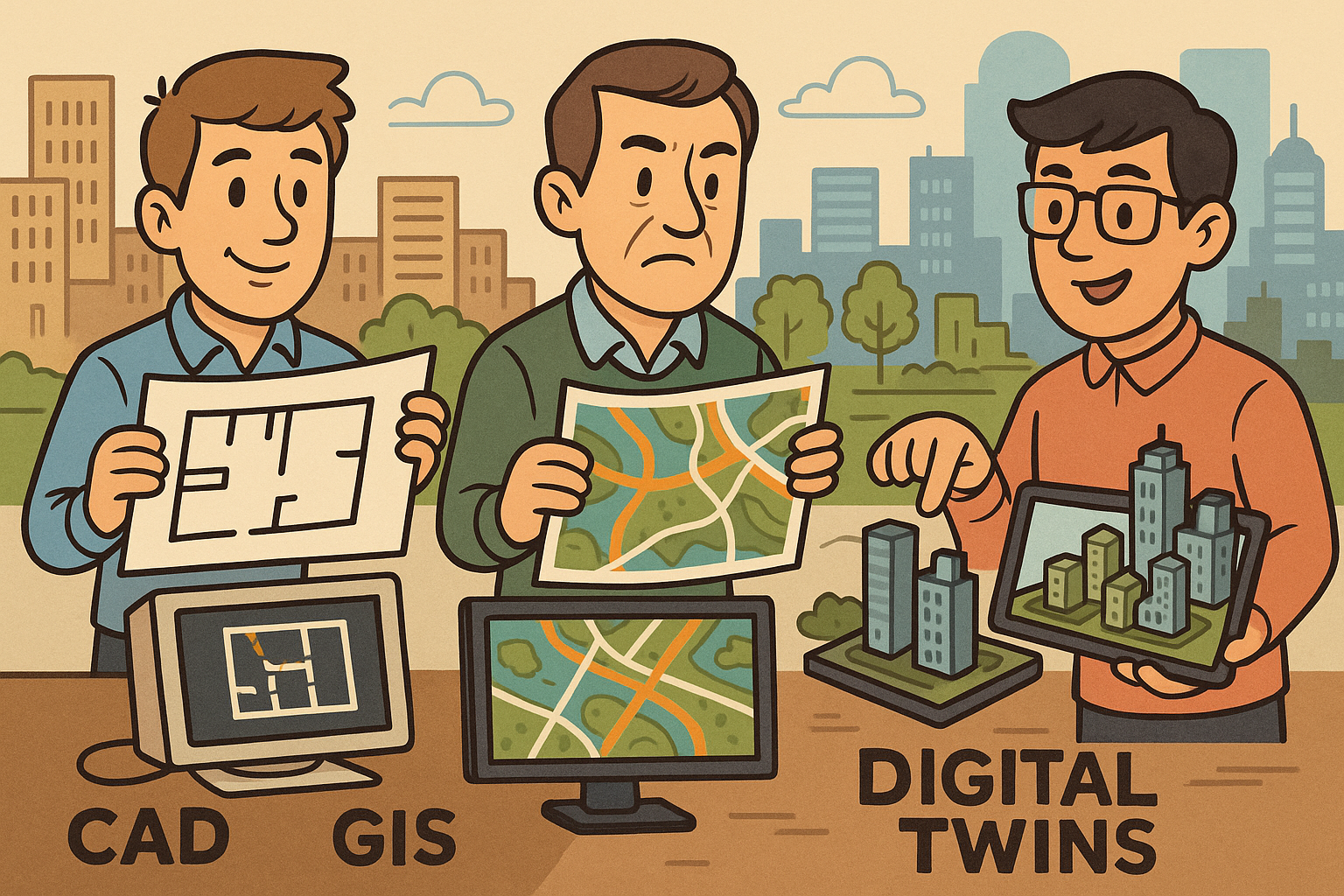
Design Software History: CAD vs GIS to Digital Twins: Six Decades of Urban Design Software, Standards, and Convergence


Introduction
Overview
The story of GIS and CAD is not merely a technical bifurcation; it is a tale of two epistemologies that shaped how cities are described, designed, and delivered. From the 1960s onward, geographers and planners learned to see the world through discrete features with attributes, while engineers and architects pursued dimensional fidelity, tolerances, and fabrication-ready geometry. Over six decades, this divergence produced strongly specialized toolchains—powerful in their own rights, yet often incompatible in the middle, where urban design decisions must balance context, regulation, geometry, and buildability. Today, those worlds are converging as standards, spatial databases, and streaming 3D make it possible to carry both semantics and precision into the same viewport. The arc of that convergence involves figures like Roger Tomlinson and Howard T. Fisher; companies including Esri, Autodesk, Bentley, Intergraph/Hexagon, and Safe Software; and standards bodies such as OGC and buildingSMART. Understanding how we arrived here clarifies why the current moment—of CityGML/CityJSON, IFC 4.3, 3D Tiles, and digital twins—feels like a turning point. It also highlights the enduring friction: coordinate reference systems, vertical datums, topological robustness, and the deep challenge of reconciling citywide semantics with survey-grade accuracy. This article tracks that history and maps what changed, what hasn’t, and where the next decade will likely take the practice of urban design computation.
Parallel origins and separate worldviews (1960s–1990s)
GIS lineage focused on geography and attribution
In the 1960s, Roger Tomlinson’s work on Canada’s CGIS gave geographic information systems their first industrial-scale expression: national land inventory data organized as features with attributes and managed through overlays. At Harvard’s Laboratory for Computer Graphics & Spatial Analysis, Howard T. Fisher incubated SYMAP, GRID, and ODYSSEY—software that taught generations to think in vector lines and raster cells, and to operationalize overlay analysis, buffering, and network tracing. These labs codified the practices of thematic mapping and the topological understanding of parcels, rights-of-way, and land-use classifications. When Jack and Laura Dangermond founded Esri, ARC/INFO’s coverage model and later the 1998 public Shapefile specification cemented an attribute-centric geodata ethos. Government mapping agencies such as the USGS and the UK’s Ordnance Survey set the parallel expectations: projections, datums, map accuracy classes, and metadata lineage were treated as first-order concerns, not afterthoughts. Together, these institutions entrenched a worldview in which “truth” is a feature with a coordinate reference system, a topology, and a robust schema of attributes. The work product was analysis-ready datasets meant for policy, environmental assessment, and regional planning—deliberately abstracted from fabrication tolerances and shop drawings. Even early municipal GIS deployments reflected this: zoning maps, census attributes, and network layers that framed decision-making long before a building footprint turned into a construction detail.
CAD lineage focused on precision geometry and fabrication
Running in parallel, CAD evolved from Ivan Sutherland’s Sketchpad conviction that a computer could be a drafting partner, not just a calculator. Through the 1970s and 1980s, systems such as CADAM (originated at Lockheed and later associated with Dassault Systèmes), Unigraphics (via McAuto and later Siemens PLM), Intergraph’s engineering platforms, Bentley’s MicroStation, and Autodesk’s AutoCAD formalized layers, dimensioning, constraints, and ultimately B-rep solids and NURBS surfaces. The engineering heart of CAD revolved around shape kernels—ACIS from Spatial (now Dassault Systèmes) and Parasolid from Siemens—that guaranteed boundary consistency, boolean robustness, and manufacturable topology. Civil-engineering branches like MOSS/MX (later Bentley MXROAD) and Autodesk’s Land Desktop (from Softdesk lineage) handled terrain, alignments, and corridors as geometry-first objects with stationing, vertical curves, and cross-sections. Precision was the moral compass: a millimeter mattered, hatch patterns mattered, drawing sets mattered. Where GIS prized projection-aware topology and attributes, CAD prized tolerances, constraints, and constructability. Output pipelines fed CAM, CNC, and fabrication, where ambiguity is fatal. This CAD worldview rightly treated coordinate systems and national datums as downstream concerns, resolvable at survey control import or on a sheet’s viewport rather than governing the model’s ontology. In practice, that meant city context was often navigated through Xrefs, block libraries, and manually aligned basemaps rather than semantically neutral, geodetically assured datasets.
Urban design gap
By the 1990s, planning departments were entrenched in GIS for zoning overlays, demographic analytics, and transport networks, while architects and engineers relied on CAD for construction documents, detail libraries, and machine-ready shop drawings. The friction surfaced exactly where urban design lives: early-stage massing, district-scale feasibility, and corridor alternatives needed both context semantics and geometric precision, but the tools made users choose. Divergent data models aggravated the schism. GIS built integrity around feature classes and topological rules (no gaps or overlaps among parcels, connectivity of street networks). CAD secured integrity through layer discipline, constrained sketches, and watertight solids. A building footprint in a planning shapefile knew its land-use category and lot coverage but not its wall thickness; a CAD model knew its member sizes and joint geometry but not its zoning compliance or floodplain status. Consequently, teams exchanged DWGs and Shapefiles that were functionally lossy: attributes vanished in one direction, dimensional fidelity and solids integrity eroded in the other. The result was an urban design gap where feasibility studies were constantly retranslated, context models were rebuilt ad hoc, and cross-domain assumptions about projection, units, and topology caused subtle misalignments that undermined trust. The stage was set for standards, spatial databases, and eventually product strategies to bridge the split.
Bridges begin: standards, databases, and product pivots (1990s–2010s)
Standards and semantics
The late 1990s to mid-2010s brought a standards-heavy push from the Open Geospatial Consortium and buildingSMART that made cross-domain exchange plausible. OGC’s WMS (1999/2000) and WFS (2002) formalized how maps and features are requested over the web, while GML introduced a carrier for complex geometries and attributes. For cities, CityGML 1.0 (2008) and 2.0 (2012) added semantic hierarchies—buildings, bridges, vegetation, transportation—with Levels of Detail (LoDs) that acknowledged both cartographic and analytical needs; CityGML 3.0 in the early 2020s broadened concepts to support dynamism and versioning, while CityJSON offered a lighter JSON encoding. Infrastructure semantics matured through LandXML (circa 2000) and, later, OGC LandInfra/InfraGML (mid-2010s), which recognized alignments, cross-sections, survey observations, and roadway elements as first-class citizens. On the building side, buildingSMART’s IFC stabilized with IFC2x3 in 2007 and IFC4 in 2013, eventually extending to IFC4.3 for roads, bridges, and rail in the early 2020s—bringing civil assets into the BIM ontology. These specifications created a lingua franca in which semantics and geometry traveled together. Their influence was practical: procurement started to specify deliverables as IFC or CityGML; software vendors implemented importers/exporters; and middleware began to translate between feature-based cities and component-based buildings. Where GIS and CAD once spoke past each other, standards gave them a shared grammar.
Spatial databases and ETL
Spatial storage matured in enterprise databases, making geospatial behavior a baseline capability rather than a special-purpose sidecar. Oracle Spatial (late 1990s) embedded spatial indexing, coordinate transformations, and topology models into mainstream RDBMS infrastructure, while PostGIS—created by Paul Ramsey and colleagues at Refractions Research in 2001—brought a powerful, open SQL geometry engine to PostgreSQL. With fast R-trees, reprojection functions, and even raster support, these platforms stored both GIS-native features and CAD-derived geometries, enabling federated queries that mixed parcels, alignments, and even triangulated surfaces. Around them, Safe Software’s FME (founded by Don Murray and Dale Lutz in 1993) emerged as the universal adaptor. Its readers and writers for DWG/DGN, Shapefile, GML/CityGML, IFC, LandXML, LAS/LAZ, and more let teams convert, validate, and enrich data across schemas without surrendering to the lowest common denominator. Critically, FME provided schema mapping and attribute expression tools that preserved meaning rather than just geometry—one could migrate a roadway centerline from LandXML to a PostGIS linestring while keeping stationing metadata intact. This stack normalized the idea that storage, transformation, and analysis are shared concerns. It also catalyzed a generation of municipal data hubs where planners, surveyors, and designers read from the same database, each retaining their native tools while querying common, authoritative layers.
Product integrations
Vendors responded with product lines designed to straddle the worlds of GIS and CAD. Autodesk Map (later Map 3D, introduced in 1996) let CAD users attach attribute tables and manage projections without leaving DWG-centric workflows; Civil 3D (2005) integrated surfaces, alignments, and corridors with GIS-aware coordinate handling. Autodesk InfraWorks (2012) pushed context-first modeling, ingesting terrain, imagery, and vector layers to support rapid corridor and massing scenarios. Esri built the other bridge: ArcGIS for AutoCAD linked CAD drawings directly to enterprise geodatabases, and ArcGIS Pro added direct reading of Revit (RVT) in 2019, opening BIM geometry and parameters to GIS analysts. Bentley offered Bentley Map and later OpenCities, bringing DGN models into a geospatial register, while Intergraph’s MGE and Hexagon’s Geospatial suite expanded CAD-GIS ties for utilities and public works; GE Smallworld specialized in utility network GIS with CAD-aware editing. QGIS (initiated in 2002 by Gary Sherman) reduced friction for municipalities to read DWG/DGN and publish to web maps, making open-source more than a viewer—it became a daily broker. The result was a pattern: CAD tools acquired attribute and CRS literacy, and GIS tools learned to host and render BIM/CAD geometry with fidelity. Although imperfect, these pivots seeded a new expectation that urban practitioners could iterate with both attribution and precision in the same session.
Urban-scale 3D, reality capture, and the rise of digital twins (2010s–2020s)
Procedural and rule-based city modeling
As city models scaled from 2D layers to volumetric context, proceduralism provided a workable answer to the combinatorics of urban form. Procedural Inc., founded by Pascal Mueller, created CityEngine with a CGA rule language that linked planning envelopes, facades, setbacks, and streetscapes into a generative pipeline. When Esri acquired Procedural in 2011, those rules moved closer to GIS data, allowing zoning attributes, parcel geometries, and network hierarchies to drive block-by-block massing. The key idea was not simply speed; it was a new coupling between planning semantics and 3D form. In CityEngine, feasibility studies could operationalize zoning text: a height limit, FAR, or frontage requirement is not just a label on a map but a parameter that shapes thousands of buildings instantly. The procedural approach also served civil modeling: corridor cross-sections and roadway typologies could be rules that reflect design standards, turning street inventories into design-ready starting points. This was the first mass-market proof that cities could be both schematic and volumetric without descending into bespoke, hand-modeled detail. It gave planners and designers a shared palette for “what-if” at urban scale, bridging the gap between attribute-rich maps and geometry-rich models.
Streaming, tiling, and web visualization
City-scale visualization required new data structures and delivery protocols. Patrick Cozzi’s work at AGI and later Cesium created CesiumJS and the 3D Tiles specification—a tiling standard for heterogeneous 3D content (meshes, point clouds, vectors) streamed on demand. This made it practical to load entire metropolitan areas on commodity hardware, with progressive level-of-detail and bounding-volume hierarchies. OGC adopted 3D Tiles as an official Standard in 2023, a milestone that brought it alongside Esri’s I3S, which itself became an OGC Community Standard in 2017. Meanwhile, glTF from the Khronos Group simplified asset transmission with compact, PBR-ready geometry, and Mapbox Vector Tiles set expectations for fast, styled 2D/2.5D basemaps. Combined with modern web GPU pipelines, these formats let stakeholders and citizens explore CAD/GIS context in the browser. The shift mattered operationally: urban designers could present corridor alternatives with streaming orthoimagery, terrain, and reference models; feedback loops shortened as comments arrived on the same scene used for analysis. Crucially, streaming protocols normalized tiling and quantization expectations across vendors, reducing the bespoke glue previously needed to serve meshes, footprints, and networks together. The web became not just a presentation medium but a design collaboration surface.
Reality capture meets GIS/CAD
Photogrammetry and LiDAR moved from exotic surveys to routine inputs, reshaping how baseline conditions enter design. acute3D’s algorithms, later commercialized by Bentley as ContextCapture after the 2015 acquisition, turned overlapping imagery into high-fidelity meshes and DSMs aligned to geodesy. Esri’s ecosystem (e.g., Site Scan, Drone2Map), Trimble’s scanning platforms, and Leica Geosystems’ airborne and terrestrial sensors provided turnkey paths from collection to deliverables. The critical advance was not just resolution; it was the ability to anchor point clouds and meshes in authoritative coordinate reference systems and vertical datums. That alignment made reality capture a credible CAD reference: corridors could be traced against lidar-derived breaklines; utilities could be reconciled against above-ground clues; facade conditions could inform refurbishment models. Additionally, these datasets plugged into 3D Tiles and I3S pipelines for web streaming, letting teams share context without shipping multi-gigabyte files. In effect, reality capture rebased the conversation about accuracy and currency: instead of arguing over outdated basemaps, teams could “walk” a scanned street in a browser, verifying constraints before a single alignment was drawn. Reality meshes became the living substrate onto which GIS layers and CAD models were co-registered.
BIM–GIS convergence in urban tools and programs
By 2017, the Esri–Autodesk partnership formalized years of user-driven integration, promising round-trips between ArcGIS Pro, Civil 3D, InfraWorks, and Revit. Connectors matured so that parcels, terrain, and utility networks could guide concept designs, and in turn, BIM elements with parameters could be visualized and queried in GIS. Parallel platforms branded themselves as digital twins: Bentley’s iTwin embraced open-source bridges like iModel.js (now iTwin.js) to synchronize design files and construction telemetry; Autodesk introduced Tandem to federate BIM handovers into operations; Esri launched ArcGIS Urban to encode plans, zoning, and projects as 3D data services; Trimble’s Cityworks leveraged its asset management heritage for municipal operations. At national and municipal scales, authoritative vector and 3D basemaps matured—Ordnance Survey MasterMap in the UK, the Netherlands’ 3D BAG, and NYC’s PLUTO dataset, among others—becoming the canonical context for site modeling, mobility studies, and feasibility. Importantly, these examples were not mere showcases; they signaled a cultural shift: planners, engineers, and architects expected to co-author city models that carry both policy semantics and construction-ready geometries. The tooling finally allowed that expectation to be met in production, not just in demos.
Conclusion: what the confluence changed—and what’s left to solve
What changed
Three shifts define the present. First, shared standards—CityGML/CityJSON for city semantics, IFC 4.3 for infrastructure-rich BIM, OGC APIs and 3D Tiles for web delivery—made it normal to exchange models where attributes and geometry remain intact. Second, iterative urban design now begins inside context: zoning rules, demographic layers, mobility networks, utilities, and environmental constraints are live inputs to parametric massing and civil alignments, not after-the-fact overlays. Third, reality capture and web streaming elevated city-scale models from presentation artifacts to design substrates usable in working meetings. Together, these changes turn previously parallel toolchains into a shared practice. Consider how routine it has become to: connect PostGIS feature services into Civil 3D; read Revit elements natively in ArcGIS Pro; push a CityGML building stock through CityEngine to test FAR and height, then stream alternatives via Cesium; federate an IFC bridge with survey scans in an iTwin for construction phasing. The distance between “GIS for context” and “CAD/BIM for detail” is narrower because the infrastructures surrounding both—standards, databases, and streaming—converged on the same expectations of identity, versioning, and performance. The field now treats semantically rich, geodetically correct canvas as a baseline, not an aspiration.
Persistent gaps
Despite progress, stubborn mismatches remain. Precision versus semantics continues to be a hard problem: survey-grade tolerances and watertight solids rarely align cleanly with citywide, schema-rich feature models. Coordinate reference systems and vertical datums still derail workflows; inch-versus-millimeter confusions and geoid-versus-ellipsoid misunderstandings propagate silently through exchanges. Topology is another fault line: parcel and street networks demand planar integrity and connectivity, while BIM assemblies need manifoldness and boolean consistency; cross-validating those models at scale is brittle. Governance is immature compared to PDM/PLM: urban “twins” need provenance, versioning, and entitlement controls that match the rigor aerospace and automotive achieved decades ago. The industry also struggles with lifecycle semantics: construction states, temporary works, and as-built deviations rarely loop back into authoritative city models. Practical pain points include: mismatched LoDs between CityGML and BIM; lossy flattening of parametric behaviors when exporting; insufficiently expressive schemas for utilities that must satisfy both network analysis and physical assembly; and the operational reality that municipal IT teams lack resources to maintain streaming infrastructure and schema evolution simultaneously. Bridging these gaps requires not only more standards but also better validation tools and shared testing corpora.
What’s next
The near future points to consolidation around open APIs and more fluent semantic mappings. OGC API—Features, Tiles, and Processes—will replatform geospatial services on simple, HTTP-first contracts, aligning GIS and web engineering cultures. Broader adoption of 3D Tiles across vendors will reduce bespoke 3D delivery formats and make mesh-plus-attribute content routine. On the semantics front, buildingSMART and OGC collaborations will mature mappings between IFC and CityGML/CityJSON, preserving both component intelligence and city context. AI will accelerate conflation: point clouds segmented into building parts, utilities inferred from street furniture, and parcels reconciled against occupancy footprints; rule-checking trained on codes will make automated compliance a design companion rather than a post-hoc audit. Expect parametric urban systems—rules for FAR, daylight, mobility, and stormwater—to become deployable services callable from CAD, GIS, or the browser. Finally, an organizational shift is coming: municipal and AEC teams will invest in data governance—versioned twins, lineage tracking, and rights management—bringing the discipline of PDM/PLM into city-making. The long arc leads from parallel toolchains to a shared plane where planners, engineers, and architects co-author models that are simultaneously analytical, precise, and buildable. When that happens at scale, the city model stops being a deliverable and becomes a living operating system for urban decisions.
Also in Design News