Your Cart is Empty
Leveraging Geographic Data for Sustainable Landscape Design: Tools and Techniques
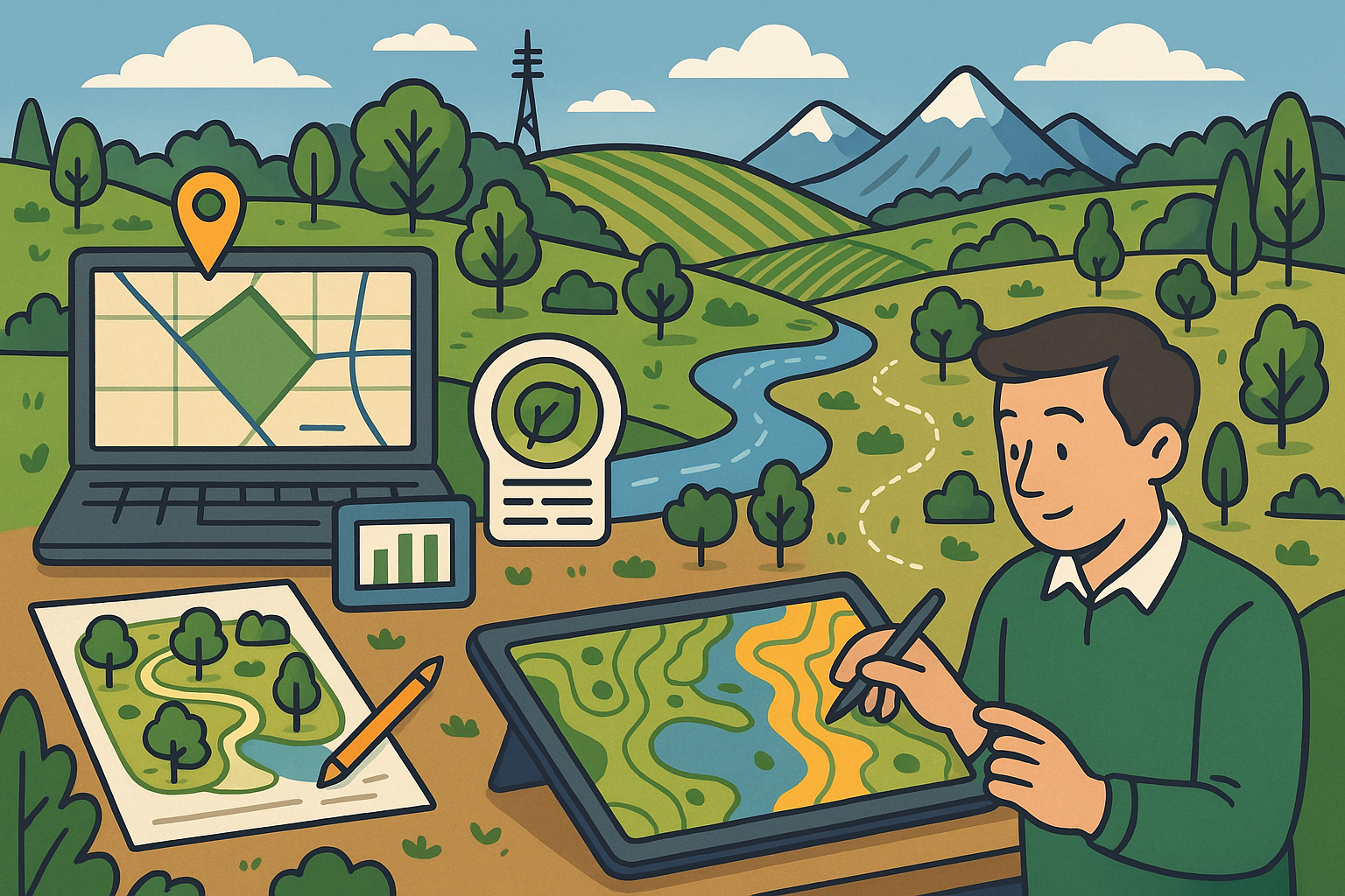


Foundations of Geographic Data in Eco-Friendly Landscape Designs
The foundation of modern eco-friendly landscape designs is firmly rooted in the integration of diverse geographic data types that are critical in understanding the physical and environmental context of a site. This paradigm shift relies on the utilization of varied datasets such as topographical data, environmental metrics, and climatic data to generate accurate models that reflect real world conditions. The integration of these data types enables designers and planners to optimize site potential while respecting ecological constraints. In today’s design software, by leveraging advanced analysis techniques, professionals can now amalgamate these multifaceted data sources to produce layouts that minimize negative impacts on natural habitats while maximizing positive environmental outcomes. As the discipline continues to evolve, an increasing emphasis is being placed on the role of geographic data in informing sustainable practices and environmental planning. By synthesizing information from multiple sources, eco-friendly landscape projects benefit from enhanced accuracy in topographical interpretation, environmental conditions, and climatic variations, leading to design solutions that are simultaneously creative and responsible.
Overview of Geographic Data Types
A critical examination of the different types of geographic data reveals just how integral these components are for modern, environmentally conscious landscape design. Topographical data provides detailed information about the shape and features of the landscape, outlining everything from gradient changes to elevations. Meanwhile, environmental data covers various factors including soil composition, water drainage patterns, and vegetation coverage which are fundamental in determining a site’s ecological sensitivity. Climatic data, on the other hand, encompasses information such as temperature fluctuations, rainfall patterns, and seasonal changes, all of which are essential when evaluating the long-term viability of a design. The convergence of these multiple data types ensures that the landscape design process is not only innovative but also well-informed by the underlying physical conditions of the environment. Detailed analysis and careful interpretation allow landscape architects and environmental planners to create comprehensive assessments that anticipate potential challenges and embrace design opportunities that favor sustainable ecosystems. In this context, advanced analytics in design software pave the way for a highly integrated solution that transcends traditional design methodologies by embedding robust, data-driven approaches at the core of the planning process.
The Role of GIS and Mapping Technologies
Geographic Information Systems (GIS) and contemporary mapping technologies occupy a central role in advancing the capabilities of landscape design software. With the introduction of sophisticated GIS mapping, designers can visually explore and analyze spatial data sets to uncover patterns and relationships that influence the broader environmental context of a project. Technologies that empower these tasks offer unprecedented resolution and detail, converting raw geographic data into actionable insights which facilitate strategic design decisions right from the conceptual phase of projects. The computational power behind tools that employ GIS mapping platforms is significant because it allows for the simulation of numerous environmental conditions and spatial constraints, ensuring that potential hazards or sustainability issues can be preemptively addressed. Moreover, GIS tools allow for the layering of different datasets – including topographical, environmental, and climatic layers – to form a comprehensive narrative of the project site. This process is further enhanced by the integration of modern APIs and real-time data feeds that update the design software as new information becomes available. Combining these technological advances with traditional design sensibilities results in methodologies that are both agile and robust, paving the way for constructions that strive to achieve harmony with local ecosystems while also embracing innovation.
Integrating Geographic Data for Sustainability
The effective integration of accurate geographic data is the cornerstone for advancing sustainability and environmental planning objectives in landscape design. By incorporating precise datasets directly into the design process, professionals are empowered to make informed decisions that align architectural ambitions with eco-friendly standards. The reliability of geographic data—encompassing aspects such as satellite imagery, LiDAR-based measurements, and climate analytics—ensures that designs are not only aesthetically appealing but also environmentally responsible over the long term. In the context of sustainability, leveraging geographic data plays a critical role in assessing resource availability, potential environmental impacts, and the overall site feasibility. Through rigorous data validation and calibration against field observations, design architects are better equipped to identify both the opportunities and constraints inherent in any given site, thus fostering projects that are resilient, adaptable, and environmentally sound. Among the benefits of such integration are the highlighted advantages of minimizing soil erosion, optimizing water conservation, and enhancing biodiversity through carefully planned plantings. Additionally, the consistent use of real-time data in the planning phase helps mitigate risks, such as those associated with climate variability, thereby ensuring that installations remain viable under changing environmental conditions.
Tools, Technologies, and Integration Techniques
In the rapidly evolving field of eco-friendly landscape design, the synergy between traditional design methodologies and modern data-driven approaches is facilitated by an array of advanced software platforms and tools. These platforms combine the analytical prowess necessary to process complex geographic datasets with the robust visualization capabilities that cater directly to design needs. By integrating cutting-edge mapping technologies with reliable data sources, these tools provide designers with detailed insights that ensure every element of the design is informed by practical environmental considerations. Modern design software is pushing the envelope by seamlessly merging intuitive interfaces with powerful back-end computation engines, delivering performance that scales with both project complexity and data intensity. These technological advances are not only a testament to modern software engineering but also a pivotal component in the overall drive towards achieving environmental sustainability. The infusion of geographic data into design systems engenders several benefits, such as enhanced accuracy, reliability, and creative flexibility. Through the design software’s ability to harness and interpret data from various sources, designers can perform iterative simulations that predict outcomes under different environmental scenarios, ultimately leading to practical and ecologically responsible design solutions.
Key Software Platforms and Their Capabilities
The landscape design industry has seen a surge in the development of specialized software platforms uniquely designed for merging the realms of aesthetic design and geographic data analytics. Tools such as integrated CAD applications combined with GIS capabilities have emerged as industry standards, offering a comprehensive suite of features that cater to expansive project requirements. These platforms encapsulate elaborate design utilities with advanced geospatial analysis, enabling the precise mapping of site-specific characteristics. Among the highlighted features in these platforms are automated data layering, real-time environmental simulations, and customized reporting functions that allow users to extract intricate details about a site’s physical and climatic properties. This integration is achieved by harnessing robust algorithms that allow for the seamless transfer and interpretation of data from multiple sources into a coherent and intuitive workspace. Moreover, these tools generally support a variety of file formats and coordinate systems to ensure data compatibility, making the process of merging digital terrain information with design elements remarkably fluid. Designers benefit from these platforms by using a suite of features that significantly reduce manual rework, enhance decision-making accuracy, and improve overall workflow efficiency.
Data Sources and Acquisition Methods
A comprehensive understanding of available data sources and their respective acquisition methods remains fundamental to the practice of eco-friendly landscape design. Data acquisition in modern design applications includes the integration of satellite imagery, airborne LiDAR scans, and datasets obtained from open data initiatives that are provided by governmental and non-governmental agencies. Satellite imagery offers a macroscopic perspective of the landscape, enabling design professionals to monitor vast and diverse areas in high resolution. LiDAR, a technology that employs light detection and ranging, provides extremely precise three-dimensional models that capture subtle terrain features and vegetation details. These acquisition methods come with their distinct advantages and technological applications, ensuring that no detail of the landscape is overlooked. Furthermore, open data initiatives have democratized access to high-quality geospatial data, fostering an era where critical information is available to a broader base of professionals at little to no cost. The combination of these robust data sources fuels the analytical processes found in today’s design software, thereby enhancing both the reliability and comprehensiveness of project analyses and ultimately setting new benchmarks in the design industry.
Techniques for Data Compatibility and Seamless Integration
To achieve seamless integration within design workflows, various techniques are employed to ensure data compatibility and fluid interoperability between traditional design elements and modern geographic datasets. One effective technique involves the standardization of coordinate reference systems, ensuring that spatial information across different datasets is consistent and aligned. Another fundamental approach is to adopt robust transformation tools that are capable of recalibrating data formats, which is particularly important when integrating satellite imagery with ground-based measurements. Additionally, industry best practices advocate the use of data validation protocols that rigorously assess the quality and relevance of incoming geospatial information. These techniques include data segmentation, error correction, and smoothing algorithms that help bridge the gaps between disparate data sources. The following bulleted list outlines some of the core techniques:
- Standardizing spatial reference systems
- Implementing robust transformation and integration tools
- Adopting rigorous data validation and quality control procedures
- Utilizing multi-source data layering for comprehensive analysis
Strategies for Developing Eco-Friendly Landscape Designs
Developing eco-friendly landscape designs requires the confluence of innovation, data precision, and a rigorous adherence to sustainability principles. By carefully leveraging geographic data, design professionals can conduct thorough site assessments that evaluate both the environmental potential and the limitations of a given location. This process is oriented toward maximizing the natural resources available while minimizing adverse impacts on local ecosystems. Modern design software provides a suite of tools that merge detailed geospatial analysis with advanced modeling capabilities, allowing designers to explore an extensive range of design scenarios. The behavior of natural elements such as water flow, solar exposure, and soil composition can be simulated within the software, and this predictive analysis plays a pivotal role in establishing design guidelines aimed at pollution control, habitat preservation, and resource conservation. Professionals across the landscape design spectrum are increasingly incorporating analytical feedback loops into their projects, ensuring that every modification is rooted in empirical evidence. In addition, the integration of intuitive visualization tools within design platforms makes the entire process more engaging, transparent, and collaborative among team members. Ultimately, the effective implementation of these strategies fosters projects that are not only innovative and aesthetically appealing but also environmentally sustainable and resilient to future challenges.
Best Practices in Utilizing Geographic Data
One of the most essential elements of eco-friendly landscape design is the utilization of best practices when working with geographic data. Designers should systematically integrate comprehensive environmental assessments into their workflows, which incorporate a variety of data types to paint a holistic picture of the project site. This approach involves rigorous data collection, verification of data integrity through cross-referencing multiple sources, and continuous updates to reflect changing environmental conditions. Some critical best practices include:
- Conducting thorough site surveys combined with remote sensing technologies
- Integrating real-time environmental monitoring systems
- Utilizing predictive models to simulate long-term ecological impacts
- Maintaining an iterative feedback loop to refine design solutions
Optimizing Workflows and Merging Software Capabilities
The success of eco-friendly projects is equally dependent on the integration of advanced design software features with the analytical capabilities of geographic information systems. This convergence paves the way for a streamlined, dynamic workflow that empowers designers to work collaboratively and efficiently across multiple stages of a project. The blend of traditional design tools with GIS technologies has given rise to a new era where iterative design, real-time feedback, and scenario simulation are seamlessly interwoven into the creative process. Techniques for workflow optimization emphasize the importance of modular design approaches, ensuring that changes in one part of the system do not disrupt the overall project integrity. In addition, the implementation of automated data processing pipelines minimizes manual intervention, reducing both error margins and turnaround times for project deliverables. The alignment of these technologies is best exemplified by software platforms that enable multi-layered modeling, allowing designers to toggle between different data views and simulation outcomes. This multifaceted integration does not only fortify the relationship between data and design but also significantly enhances project predictability. Such an approach facilitates greater initiative among project stakeholders, fostering an operational framework that is both robust and highly adaptable, setting new benchmarks in the competitive world of landscape design.
Conclusion
The integration of comprehensive geographic data into eco-friendly landscape design represents a significant milestone in the evolution of design software. This new paradigm allows designers to develop projects that are both creative and environmentally responsible. By merging traditional design practices with advanced analytical tools, professionals can create spaces that are visually engaging while promoting sustainability. Through the careful use of data sources such as satellite imagery, LiDAR, and other remote sensing technologies, the industry has moved toward designs that are informed by a deep understanding of both natural and built environments. The deliberate incorporation of key data sets—ranging from topographical information to detailed climatic records—ensures that designs do not merely exist aesthetically but operate harmoniously with their surroundings. The combined efforts of adopting best practices, utilizing modern software tools, and maintaining agile workflows have elevated the practice of landscape design into one that meets the rigorous standards required for contemporary sustainability goals.
Summary of Techniques and Impacts
In summary, geographic data integration has redefined the landscape design discipline by endowing eco-friendly projects with unparalleled precision and predictive power. The use of detailed datasets to inform decisions is essential in achieving designs that address ecological nuances and sustainability challenges. Designers increasingly depend on a convergence of topographical, climatic, and environmental data, which is then refined using advanced software algorithms and GIS-based simulations. This symbiotic relationship between data and design not only aids in forecasting long-term outcomes but also paves the way for innovative environmental remediation practices. The trends discussed have underscored the critical impact of data-driven methodologies in elevating the overall planning process. In doing so, design software continues to evolve, blending traditional drafting with robust analytical capabilities that tailor every project to its natural context. The ongoing evolution of these systems indicates that the future holds even more refined and intelligent integration techniques that can anticipate ecological variations, ensuring that landscape designs remain both resilient and adaptive.
Future Outlook: Emerging Trends and Innovations
Looking ahead, the fusion of geographic data with design software is likely to spur emerging trends and technological innovations that will further transform the field of landscape design. With advancements in machine learning and artificial intelligence being increasingly integrated into design workflows, future software is expected to offer even more precise predictions regarding environmental impacts and site potentials. Moreover, the development of high-fidelity 3D visualization tools, increasingly coupled with real-time data feeds, promises to deliver experiential environments that can simulate the long-term effects of climate change and human intervention. These innovations are set to create a feedback loop where design decisions are continuously refined based on emerging data trends, ensuring that the balance between beauty and sustainability continues to improve over time. As designers continue to adopt these cutting-edge tools, the resulting projects will be characterized by a heightened awareness of environmental limitations while exploring creative ways to mitigate them. The convergence of emerging technologies, improved data acquisition methods, and sophisticated analytics represents an exciting frontier for eco-friendly landscape design, one in which sustainability and innovation will move forward hand in hand.
Also in Design News