Your Cart is Empty
Design Software History: The Evolution of GIS and Design Software Integration in Urban Planning: Historical Insights and Future Directions
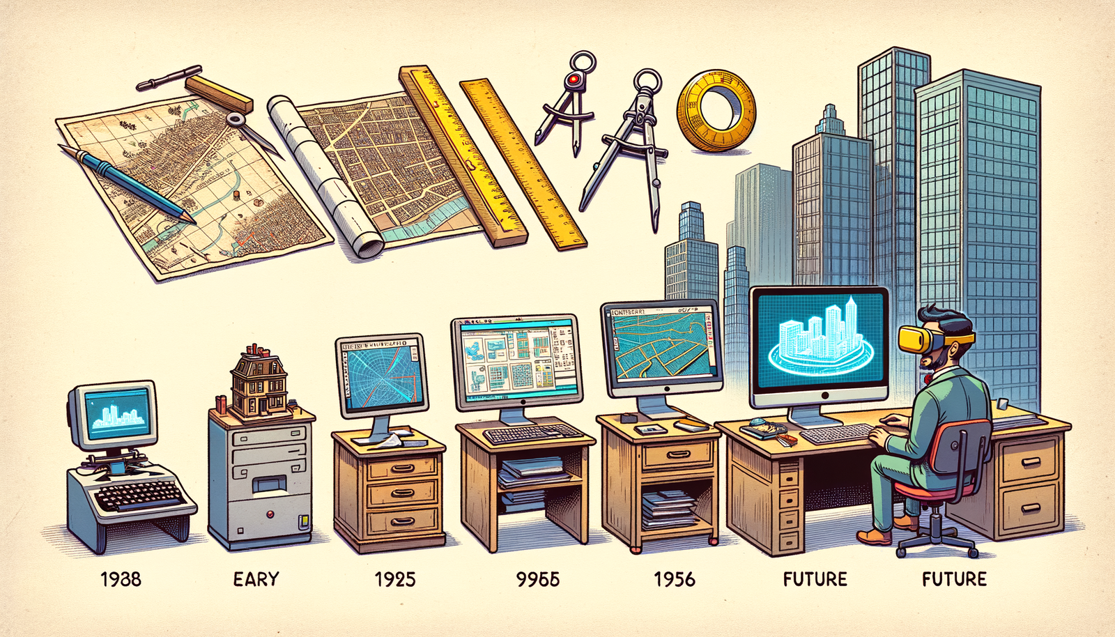


In the realm of urban planning, the convergence of Geographic Information Systems (GIS) and design software has significantly transformed how cities are conceptualized and developed. This integration has revolutionized data analysis, visualization, and the overall planning process, enabling more dynamic and informed decision-making. Understanding the historical progression of this convergence offers valuable insights into the technological advancements and collaborative efforts that have shaped modern urban environments.
Historical Background of GIS in Urban Planning
The inception of Geographic Information Systems dates back to the 1960s, a period marked by rapid technological innovation and a burgeoning interest in spatial data analysis. One of the pioneering figures in GIS development was Roger Tomlinson, often referred to as the "Father of GIS." Working with the Canada Land Inventory, Tomlinson developed the first true GIS system, which was instrumental in managing and analyzing large datasets related to land use and resource management. Institutions like Harvard University's Laboratory for Computer Graphics and Spatial Analysis also played a pivotal role, spearheaded by figures such as Howard T. Fisher. This laboratory developed early GIS software like SYMAP and GRID, laying the groundwork for future advancements.
During this era, GIS applications in urban planning were primarily focused on mapping and basic spatial analysis. Planners were able to visualize urban landscapes, assess land use patterns, and identify geographical constraints. However, the limitations of early GIS were evident. The technology was constrained by computational capacities, limited data availability, and rudimentary visualization capabilities. Urban planners often faced challenges in integrating GIS data with design processes, as the tools were not yet sophisticated enough to handle complex urban systems or to facilitate interactive design interventions.
Early Integration Attempts
The late 1970s and early 1980s witnessed initial attempts to bridge the gap between GIS and design software. As urban challenges became more complex, there was a growing recognition of the need for tools that could both analyze spatial data and support the creative aspects of urban design. Early adopters endeavored to integrate GIS with Computer-Aided Design (CAD) software, aiming to combine analytical capabilities with detailed design functionalities. Technological challenges were significant during this period. The lack of standardization in data formats, limited interoperability between software platforms, and the high cost of computing resources posed substantial obstacles. Additionally, the user interfaces were often not intuitive, requiring specialized training and limiting widespread adoption among urban planners.
Despite these challenges, several pioneering efforts laid the foundation for future integration. Organizations began exploring the potential of GIS-CAD interoperability, recognizing the benefits of a unified platform for planning and design. Collaborations between software developers, urban planners, and government agencies started to emerge, fostering a multidisciplinary approach to urban development. These early integration attempts highlighted the necessity for advancements in both GIS and design software technologies to achieve seamless convergence.
Advancements in GIS Technology
The 1990s marked a significant turning point for GIS technology, characterized by the introduction of more sophisticated tools and expanded capabilities. Companies like Esri, founded by Jack Dangermond, led the charge in developing comprehensive GIS solutions. Esri's ArcGIS platform became a cornerstone in the industry, offering enhanced data visualization, spatial analysis, and user-friendly interfaces. Key innovations during this period included the development of desktop GIS applications, the incorporation of remote sensing data, and improvements in data storage and processing power.
These advancements facilitated greater integration with design software by providing more robust data visualization and analysis tools. The improved ability to handle complex datasets allowed urban planners to conduct more detailed spatial analyses, identify patterns, and make informed decisions. Enhanced visualization capabilities meant that GIS data could be more effectively incorporated into design workflows, bridging the gap between analysis and creative design processes.
Advancements in Design Software
Parallel to the developments in GIS, design software underwent significant evolution from basic 2D drafting tools to sophisticated 3D modeling platforms. Companies like Autodesk played a crucial role in this transformation. Autodesk's introduction of AutoCAD revolutionized the design industry by providing a powerful tool for creating precise 2D drawings. The subsequent development of software like Autodesk Revit and 3ds Max expanded capabilities into the realms of Building Information Modeling (BIM) and advanced 3D visualization. These tools allowed architects and planners to create detailed models, simulate real-world conditions, and collaborate more effectively.
The transition from 2D to 3D modeling was particularly impactful. It enabled professionals to create more realistic representations of urban environments, assess design implications, and engage stakeholders through immersive visualizations. The advancements in design software provided a critical platform for integrating detailed spatial data from GIS, allowing for more comprehensive and data-driven design processes.
Key Breakthroughs in Integration
The late 1990s and early 2000s saw significant milestones in software development that allowed for seamless GIS-design interoperability. One of the key breakthroughs was the development of interoperable data formats and the adoption of industry standards like the Geographic Markup Language (GML). Open Geospatial Consortium (OGC) played a pivotal role in promoting open standards, which facilitated data sharing and integration across different software platforms. The influence of open-source platforms also became evident, with projects like QGIS providing accessible GIS tools that could be customized and extended to suit specific integration needs.
Moreover, APIs and software development kits (SDKs) became more robust, enabling developers to create plugins and extensions that bridged GIS and design software. For instance, the integration of GIS data into CAD environments became more streamlined, and BIM tools started to incorporate spatial analysis functionalities. These technological advancements reduced barriers to integration, allowing for more cohesive workflows and fostering innovation in urban planning and design practices.
Urban Planning Implementations
The convergence of GIS and design software has had a profound impact on urban planning implementations. Planners and designers have been able to leverage integrated tools to analyze complex spatial data, model urban systems, and create designs that are both aesthetically pleasing and functionally efficient. The impact on urban development has been significant, including improvements in zoning practices, infrastructure planning, and resource allocation. Planners can now simulate traffic patterns, assess environmental impacts, and evaluate socioeconomic factors within a unified platform.
One of the key benefits of this integration is the ability to engage in scenario planning. Planners can develop multiple design scenarios, assess their potential outcomes, and make data-driven decisions. This approach enhances transparency and fosters community engagement, as stakeholders can visualize and understand the implications of planning decisions. The integration also supports sustainable development goals by enabling planners to incorporate environmental considerations into the design process more effectively.
Environmental and Sustainability Applications
GIS-design integration has been instrumental in advancing environmental and sustainability applications within urban planning. By combining spatial analysis with design capabilities, professionals can conduct comprehensive environmental impact assessments. They can model natural resource use, simulate the effects of urban growth on ecosystems, and develop strategies to mitigate negative impacts. For instance, planners can analyze flood risk areas, integrate green spaces into urban designs, and plan for efficient energy use.
Projects focused on sustainable urban growth have greatly benefited from this integration. Planners can create designs that promote walkability, optimize public transportation networks, and reduce carbon footprints. The ability to model and visualize these factors enhances the effectiveness of sustainability initiatives and supports the development of resilient urban environments. The integration of GIS and design software thus plays a critical role in addressing the challenges of climate change and promoting sustainable development practices.
Influential Figures and Organizations
The progress in integrating GIS and design software has been driven by influential figures and organizations committed to innovation and collaboration. Leaders like Jack Dangermond of Esri have been instrumental in advancing GIS technology and promoting its integration with other disciplines. Organizations such as the Open Geospatial Consortium have fostered collaboration between tech companies, government bodies, and academic institutions to develop open standards and promote interoperability.
Collaborative efforts between software companies have also been significant. Partnerships between Autodesk and Esri, for example, have resulted in integrated solutions that enhance the capabilities of both GIS and design software users. Government agencies have played a role by adopting integrated platforms for urban planning and encouraging the development of technologies that serve public interests. The collective efforts of these individuals and organizations have been crucial in overcoming integration challenges and advancing the field.
Current Trends and Future Directions
In the contemporary landscape, several trends are shaping the future of GIS and design software integration. The rise of cloud computing has enabled more accessible and collaborative platforms, allowing stakeholders to work together in real-time from different locations. The incorporation of artificial intelligence and machine learning is enhancing predictive capabilities, enabling more sophisticated analyses and design optimizations. Additionally, advancements in virtual and augmented reality are offering new ways to visualize and interact with urban designs.
Potential future developments include the further integration of Internet of Things (IoT) data, providing real-time insights into urban systems. This could significantly impact urban planning by enabling adaptive and responsive design strategies. The continued emphasis on open-source software and open data initiatives is likely to enhance accessibility and drive innovation. These trends suggest a future where urban planning is increasingly data-driven, collaborative, and dynamic.
Lessons Learned and Challenges Ahead
The historical integration efforts between GIS and design software offer several lessons. Collaboration between disciplines is essential for successful integration, highlighting the need for interdisciplinary education and communication. The importance of open standards and interoperability cannot be overstated, as they enable seamless data exchange and reduce duplication of efforts. Furthermore, user-centered design of software tools enhances adoption and effectiveness.
Despite significant progress, ongoing challenges persist. Data interoperability remains a concern, particularly with the proliferation of new data sources and formats. Software compatibility issues can hinder integration efforts, requiring continuous collaboration between developers. Privacy and security considerations are increasingly important as more data is collected and shared. Addressing these challenges will require sustained effort and innovation from all stakeholders involved.
The Transformative Impact of Integration
The convergence of GIS and design software has undoubtedly transformed urban planning. It has enabled planners to move beyond traditional methods, embracing a holistic approach that integrates data analysis, visualization, and design. This integration has facilitated more informed and data-driven decision-making, leading to better-designed urban environments that meet the needs of communities. It has also empowered stakeholders by providing tools that enhance transparency and engagement.
The role of design software in this transformation is central. By providing platforms that can incorporate complex spatial data and support creative design processes, these tools have expanded the possibilities of what can be achieved in urban planning. The continued integration of GIS and design software promises to further enhance the ability of planners to address contemporary urban challenges, promoting sustainable and resilient cities for the future.
Also in Design News