Your Cart is Empty
Design Software History: Evolution of Urban Planning Modules in Design Software: From CAD Drafting to Integrated Smart City Solutions


Laying the Groundwork: Introduction to Urban Planning Modules in Design Software
Urban planning modules within design software have long been a cornerstone of efforts to create modern, sustainable cities that address the ever-growing challenges of urbanization. Early in the evolution of design tools, planning digital environments for cities was primarily a manual and highly fragmented process, but the integration of planning modules has gradually transformed these workflows. Historically, these tools were built on the foundations of computer-aided drafting (CAD) technology. As urban development became more complex, planners and engineers recognized that the digital tools they used required a new set of functionalities to integrate planning data, simulate infrastructural changes, and provide a comprehensive spatial understanding of urban environments. This transition was made possible by the merging of civil engineering practices with emerging information technologies that allowed for dynamic mapping, three-dimensional modeling, and later, real-time analytics. The significance of these modules is not only found in their ability to visualize the built environment but also in their capacity to aid in achieving efficient land use planning, optimizing transport networks, and mitigating environmental impacts.
Historical Background and Early Integration
In the early stages of digital mapping and design, key terms such as "urban digital mapping" and "spatial analysis" were revolutionary because they facilitated the transformation from paper-based blueprints to dynamic, computer-generated simulations of urban space. The process was progressive; this evolution harnessed the collective knowledge of civil engineers, architects, and computer scientists who worked together to solve real-world challenges as urban populations exploded into new metropolitan centers. Pioneers in this field, including influential individuals at companies like Autodesk, Bentley Systems, and ESRI, laid the foundation for modern urban planning by incorporating robust data management and visualization techniques into their software suites. Influential figures in early computer-aided drafting and geographic information systems (GIS) pushed the boundaries of what was possible by experimenting with digital representations of entire cities. This early work not only introduced essential terminology but also pioneered methods for multi-layered data integration, critical for simulating urban growth and infrastructure development. Their contributions have resulted in software solutions that now empower urban designers all over the world to develop more resilient, better planned urban spaces.
Key Definitions and the Evolution with Civil Planning
It is important to recognize that urban planning modules are not isolated components; they evolved in tandem with broad trends in civil engineering, architecture, and computer science. Terms like computer-aided design (CAD), geometric modeling, and spatial data infrastructure have specific meanings and historical roots that interlace with the digital transformation of urban planning. The incorporation of these key definitions into the development process allowed for a richer, data-driven approach to city design. In practical terms, early software provided limited mapping capabilities primarily centered on drafting lines and geometric shapes, while modern platforms incorporate simulation, data analytics, and even environmental impact assessments. With the increasing complexity of projects, the emphasis shifted towards creating unified digital environments that break down silos between different types of infrastructure planning. Over the decades, the evolution of urban planning modules has underscored the importance of an integrated, collaborative approach to designing cities that are not only efficient in logistics and transport but also socially and environmentally sustainable.
Evolution of Urban Planning Modules: From Basic CAD to Integrated Urban Solutions
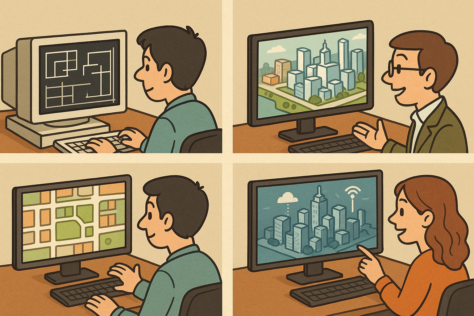
The journey from simple CAD drafting systems to contemporary, integrated urban planning platforms reflects a significant evolution in design software over the past decades. Initially, computer-aided design tools were developed primarily for the production of technical drawings, which served as the backbone of manufacturing and engineering. As the fields of urban planning and civil engineering expanded in scope, the limitations of these basic drafting tools became apparent. Planners needed solutions that could not only create static blueprints but also integrate geospatial data to enable more sophisticated spatial analysis. This necessity prompted the introduction of Geographic Information Systems (GIS) into the design workflow. The adoption of GIS allowed for dynamic mapping and spatial data management, meaning that urban planning modules within design software could now accommodate the complexities of terrain, population density, land use, and environmental factors.
CAD Drafting and the Advent of GIS Integration
Early efforts in integrating urban planning required a radical shift from isolated CAD systems to a more holistic approach where data from GIS could be incorporated to provide context. Pioneering companies and research teams began merging these technologies in ways that enabled a deep understanding of spatial relationships. The early integration of GIS and CAD allowed users to harness the strengths of both systems: the precision of drafting and the multidimensional analysis capabilities of GIS. This shift was characterized by several key developments, including:
- Enhanced Precision: The combination of CAD and GIS technologies ensured that designs maintained strict engineering tolerances while also accounting for large-scale geographical constraints.
- Complex Data Handling: Urban planning modules evolved to incorporate layers of data—from road networks and utilities to demographic and environmental information—thus offering planners a more comprehensive picture of the urban landscape.
- Dynamic Analysis Capabilities: Built-in analytical tools enabled both simulation and predictive modeling, allowing users to test various design scenarios against realistic urban conditions.
Role of Influential Companies and the Shift to Unified Design Environments
Major companies have driven the evolution of these modules with their ongoing innovations and forward-thinking approaches. Industry giants such as Autodesk, Bentley Systems, and ESRI have each played a pivotal role in shaping the integrated urban planning solutions we rely on today. These companies invested in developing functionalities that went beyond mere drafting, incorporating advanced algorithms, real-time data analytics, and a robust interface for multi-disciplinary collaboration. Their contributions include:
- Autodesk: Pushed the boundaries of 3D modeling, enabling more sophisticated visualizations of urban landscapes and supporting the transition to BIM (Building Information Modeling) practices.
- Bentley Systems: Specialized in creating robust civil and infrastructural planning tools that integrate seamlessly with GIS for comprehensive management of urban projects.
- ESRI: Cemented the role of GIS in urban planning by continually expanding its spatial analysis capabilities, thereby providing foundational data services that support complex planning operations.
Innovations and Industry Impact: Incorporating Simulation, Analytics, and Sustainability
In recent years, the integration of advanced simulation, data analytics, and sustainability assessment features into urban planning modules has revolutionized the design software landscape. These innovations have been critical in addressing the complex challenges of modern urban development. The incorporation of simulation tools, for instance, has enabled planners to model a range of variables such as real-time traffic flow, zoning impact, and environmental stress factors over time. Such dynamic modeling capabilities empower urban planners to design smarter, more resilient cities by predicting future scenarios and testing design modifications in a controlled environment. Advanced data analytics further enhance these tools, allowing users to process vast amounts of data to glean insights into urban growth patterns, infrastructural load capacity, and public service efficiencies. These analytics, combined with simulation outputs, support more informed decision-making that optimizes city planning to better meet future demands.
Smart City Solutions and the Integration with Building Information Modeling
The rise of smart city solutions represents another monumental leap forward for design software, empowering municipal planners to monitor, manage, and maintain urban environments with unprecedented accuracy and efficiency. By integrating real-time data feeds from sensors, IoT devices, and social media, advanced planning modules now offer platforms for comprehensive city management. These capabilities are seamlessly combined with Building Information Modeling (BIM), which provides detailed digital representations of physical and functional characteristics of urban infrastructure. This integration has several important impacts:
- Real-Time Traffic Modeling: Urban planners can analyze and optimize traffic flow, reducing congestion and enhancing mobility within cities.
- Zoning Simulation: Tools allow for rapid modifications to zoning laws and land use scenarios to address evolving urban needs.
- Environmental Impact Assessments: Integrated simulation modules help evaluate the ecological influence of development projects, thereby promoting more environmentally conscious design practices.
Impacts on Urban Development and Decision-Making Processes
The transformation brought about by these advancements in design software is reflected in the broader urban development process. The integration of simulation and analytics into planning modules has altered decision-making by providing planners with rich, multidimensional insights that go far beyond traditional drafting. Today, decisions on urban growth, resource allocation, and infrastructure development are supported by robust evidence generated by these advanced tools. For example, planners can now evaluate multiple scenarios with varying conditions, such as different population density models or environmental constraints, and immediately see the potential impacts on urban functionality and sustainability. These comprehensive tools enable cross-disciplinary teams to collaborate effectively, ensuring that every stakeholder—from local government to private developers—is working from the same data-rich informational foundation. The result is a much more collaborative and transparent approach to urban planning, where public trust is bolstered by open access to predictive models and real-time data, ultimately leading to more informed, resilient decisions about the future of urban environments.
Conclusion: Reflecting on Transformative Impacts and Future Trends in Urban Planning Software
The historical progression of urban planning modules within design software illustrates a profound transformation from rudimentary CAD drafting to an ecosystem of integrated, intelligent tools that support every facet of urban development. Over the decades, software evolution has been driven by the need to merge robust technical capabilities with the complex realities of city planning. From early digital mapping efforts and innovative spatial analysis to the sophisticated incorporation of simulation, real-time data analytics, and sustainability assessments, each milestone in this journey has continuously pushed the boundaries of what is possible. Pioneering companies such as Autodesk, Bentley Systems, and ESRI, alongside visionary engineers and urban planners, have been integral in expanding the functionalities of design software. Their work has provided urban planners with the ability to simulate multiple scenarios and understand the dynamic interactions between urban components, leading to more resilient and adaptable urban environments.
Summation of Key Milestones and Historical Evolution
Looking back at the evolution of these systems, it becomes evident that the integration of urban planning modules has not only streamlined traditional planning workflows but has also enhanced the overall quality and transparency of urban planning processes. Early CAD systems provided the structural base that later technologies enhanced with GIS integration, advanced simulation capabilities, and data analytics, marking a significant shift towards unified digital platforms. Today’s tools support a wide range of activities—from analyzing spatial relationships and optimizing infrastructural designs to planning for environmental sustainability and integrating smart city frameworks. The journey of these software solutions is one punctuated by continuous innovation, driven by the need to address urban challenges in a holistic and adaptive manner.
Looking Ahead: Future Trends and the Continued Evolution of Urban Design Software
As we look to the future, the trajectory of urban planning modules is set to evolve even further through increased automation, enhanced data-driven decision support, and greater emphasis on sustainability. Emerging trends point towards the incorporation of artificial intelligence and machine learning algorithms that promise to refine predictive modeling, automate routine decision processes, and personalize design strategies to local conditions. Additionally, advances in cloud computing and big data analytics are expected to drive real-time collaboration over vast geographical distances, bridging the gap between local urban challenges and global best practices. Such innovations are poised to help cities confront unexpected complexities—from climate change implications to rapid demographic shifts—by offering tools that provide both foresight and adaptability. Urban planners will increasingly rely on these enhanced systems not just to simulate outcomes but to iteratively refine and optimize city designs in real time. Ultimately, the continued evolution of urban planning modules in design software represents a convergence of technology, architecture, and environmental stewardship that is crucial for shaping resilient cities of the future. With an eye towards a sustainable and inclusive future, the urban design software industry is dedicated to developing comprehensive solutions that empower communities, streamline decision-making processes, and usher in a new era of smart, data-driven urban development.
Also in Design News