Your Cart is Empty
I Agree with the Terms & Conditions [View Terms]
$6,439
Digital Delivery
Available in USA + CA
Best Price Guarantee
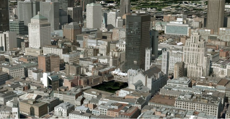
RhinoCity 2.5 for Rhino 5 is a plugin for Rhino 5 for Windows dedicated to realistic modelling of land and cities in 3D. RhinoCity 2.5 for Rhino 5 is an innovative solution to easily create, edit, analyze and display very high quality 3D textured models from data such as roof vectors, aerial imagery, point clouds or cadastral files. RhinoCity 2.5 for Rhino 5 integrates geo-Modeler to form a complete solution of high technology, offering the opportunity to apply to your data multiple 3D complex treatments without changing application. RhinoCity 2.5 for Rhino 5 is based on a Boolean calculation engine robust and ultra fast, capable of processing large dataset. RhinoCity 2.5 for Rhino 5 ensures accurate results in a record through the optimal use of multicore processors, combined time calculations in double precision.
RhinoCity 2.5 for Rhino 5 is based on a Boolean calculation engine robust and ultra fast, capable of processing large dataset.
AUTOMATIC 3D MODELINGRhinoCity™ produces exact 3D models using a unique and innovative boolean extrusion engine.By combining geometry (3D polygons) and semantic information, the RhinoCity™ 3D modeler automatically produces a 3D model whose accurancy is the guarantee of :
CityGML
RhinoCity™ allows you to:
ANALYSIS AND EDITING OF 3D GEOMETRIESThe quality of 3D data useful for modeling is a decisive factor in the accuracy of the 3D models that will be produced.To guarantee this quality and ensure that the 3D models that will result, RhinoCity™ includes all the tools needed to control and edit your 3D data.
3D TILES
3D Tiles is an open specification designed for streaming heterogenous 3D geospatial content.Submitted to the Open Geospatial Consortium (OGC) by a team led by Cesium, the OGC has approved the 3D Tiles Specification 1.0 for adoption as Community Standard.RhinoCity™ allows the 3D Tiles export of your 3D textured data!
RhinoTerrain
RhinoCity
Point Cloud
✔
Terrain Meshes
Ortho Imagery Mapping
Coordinates System Reprojection
City Modeler from Photogrammetry Vectors
Advanced Building Topology
Building Texturing from Any Aerial Picture
ShapeFile + Attributes
CityML
In order to work properly, your copy of RhinoCity 2.5 for Rhino 5 requires Rhino 5.
Sign up to get the latest on sales, new releases and more …