Your Cart is Empty
Design Software History: From Photogrammetry to SfM–MVS: Algorithmic Lineage and Heritage Workflows


From analog photogrammetry to SfM–MVS: the algorithmic lineage
Pre-digital roots
The story of contemporary, camera-based 3D capture begins long before silicon. Nineteenth-century military cartographers and surveyors laid the conceptual scaffolding that modern computer vision would industrialize. Aimé Laussedat’s pioneering terrestrial photogrammetry established that overlapping photographs could yield metrically sound reconstructions when constrained by measured baselines, while early twentieth-century optical innovators like Carl Pulfrich at Zeiss embedded that principle into robust stereo plotters. Those analog instruments, working with aerial and terrestrial imagery, depended on control networks—targets whose positions were known in a common datum—to tether relative measurements to absolute coordinates. Underlying it all were mathematical models that still anchor digital practice: epipolar geometry defines how points in one image map to lines in another; the essential and fundamental matrices capture relative pose with or without calibration; and camera models such as the pinhole projection are corrected by the Brown–Conrady lens distortion formulation to undo radial and tangential warps introduced by optics. In effect, the pre-digital era solved the highest-level problem—how to tie rays, baselines, and planes to a stable geometry—and built rugged, attack-proof workflows around it. When affordable processors, memory, and image sensors arrived, the field did not need to invent photogrammetry anew; it needed to translate a century’s worth of stereoscopic insight into software that could scale from desktops to data centers while preserving the rigor of survey-grade control.
Computer-vision era that unlocked low-cost capture
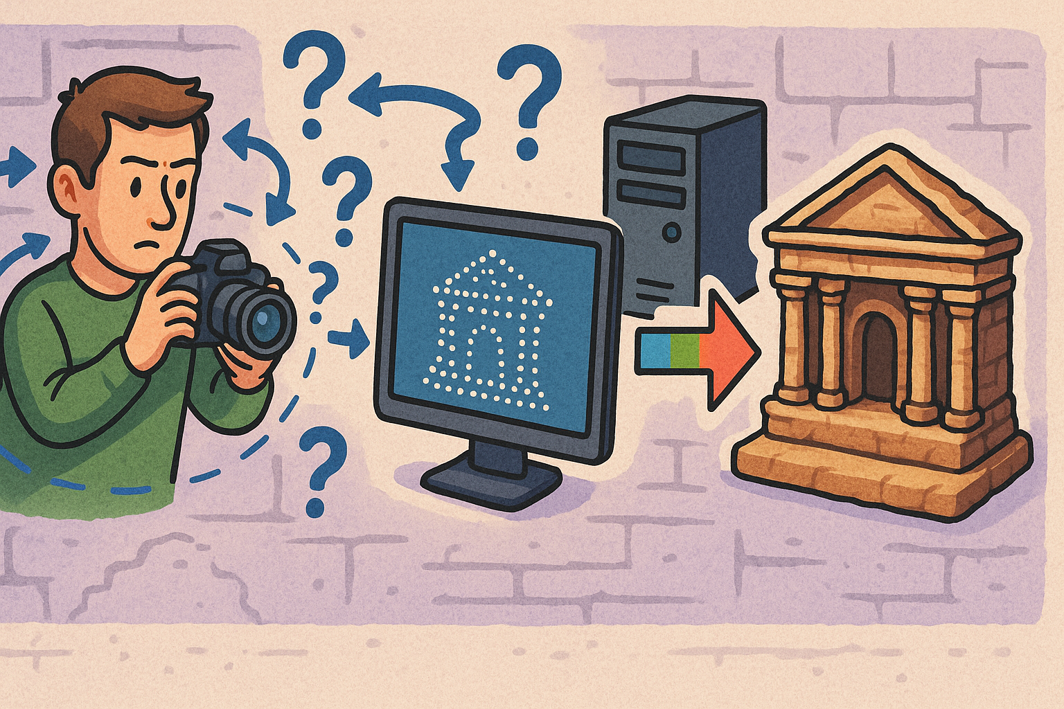
Two advances made the leap from theory to practice at commodity prices. First, automatic feature discovery: SIFT (Scale-Invariant Feature Transform) by David G. Lowe gave software the ability to detect and describe distinctive, repeatable keypoints across photographs regardless of scale and rotation, while later descriptors like SURF and ORB traded a bit of fidelity for speed and license flexibility. Robust pairing in the presence of outliers became tractable with RANSAC (Random Sample Consensus) by Martin Fischler and Robert Bolles, which could isolate geometrically consistent correspondences even in the messy reality of heritage sites. Second, global optimization matured. Classical bundle adjustment using the Levenberg–Marquardt algorithm was implemented at scale, with the SBA package by Manolis I. A. Lourakis and Antonis A. Argyros becoming a touchstone for efficient sparse Jacobians and problem structure. Texts like Hartley and Zisserman’s “Multiple View Geometry in Computer Vision” codified not just equations but practical calibration and degeneracy checks that practitioners still rely on. Meanwhile, Paul Debevec’s 1996 Campanile project showed how to combine image-based modeling and photometric rendering—bridging geometry and appearance in a way that foreshadowed today’s textured meshes. The result was a toolchain where laptops could reconstruct streetscapes and artifacts with surprising fidelity, collapsing costs that once demanded aircraft, film labs, and mechanical plotters into software-first pipelines driven by off-the-shelf cameras.
Open pipelines that heritage teams adopted
Once foundational tools escaped the lab, open implementations accelerated their adoption in cultural heritage. Structure-from-Motion (SfM) reached a wide audience with Noah Snavely’s Bundler and the “Photo Tourism” work, then spread through GUI-driven tools like Changchang Wu’s VisualSFM. Johannes L. Schönberger’s COLMAP introduced state-of-the-art incremental and global SfM with robust matching, while Pierre Moulon’s OpenMVG fed into AliceVision—powering Meshroom with a friendly front end—and MVE provided flexible multi-view reconstruction. For dense surfaces, Yasutaka Furukawa and Jean Ponce’s PMVS/CMVS stitched reliable point clouds from unordered photos, foreshadowing the wave of PatchMatch Stereo variants that swept MVS research and product teams alike. Depth-map fusion and visibility reasoning matured alongside, producing watertight surfaces ready for post processing. On that side of the pipeline, Michael Kazhdan’s Poisson and Screened Poisson reconstruction became the default for turning points into smooth, topologically coherent meshes, which could then be reduced with Garland–Heckbert quadric decimation, cleaned via Laplacian smoothing, and unwrapped with UV atlasing for high-quality texture baking and multi-band blending. The open stack had a cultural effect: conservators and archaeologists could experiment, validate, and teach with transparent tools—and compare their outputs against commercial suites—without surrendering governance of methods or data.
Accuracy, scale, and geodesy
As photogrammetry moved from visualization to stewardship-grade documentation, the discipline re-centered on accuracy budgets and geodetic rigor. Ground control points (GCPs), coded targets, and scale bars remain the most auditable way to constrain scene scale and pose, while GNSS corrections via RTK/PPK improve camera exterior orientations over large areas or UAV datasets. Teams track reprojection error distributions rather than single-number RMSE, recognizing that local anomalies—specular stone, repetitive carvings, or occlusions—can silently bias models. Radiometric consistency matters too: radiometric calibration with X-Rite color charts and stable white balance reduces texture drift, and lighting strategies such as reflectance transformation imaging (RTI) for inscriptions and cross-polarized setups help capture low-relief features without specular contamination. At landscape scale, alignment to published coordinate reference systems and the careful use of vertical datums ensure that models integrate with cadastral and GIS layers. In short, heritage teams adapted survey-grade discipline to camera-based workflows, proving that SfM–MVS could meet the dual mandate of rich texture and dependable measurement so long as the field protocol, control strategy, and QA metrics were designed into the project from the outset rather than appended as an afterthought.
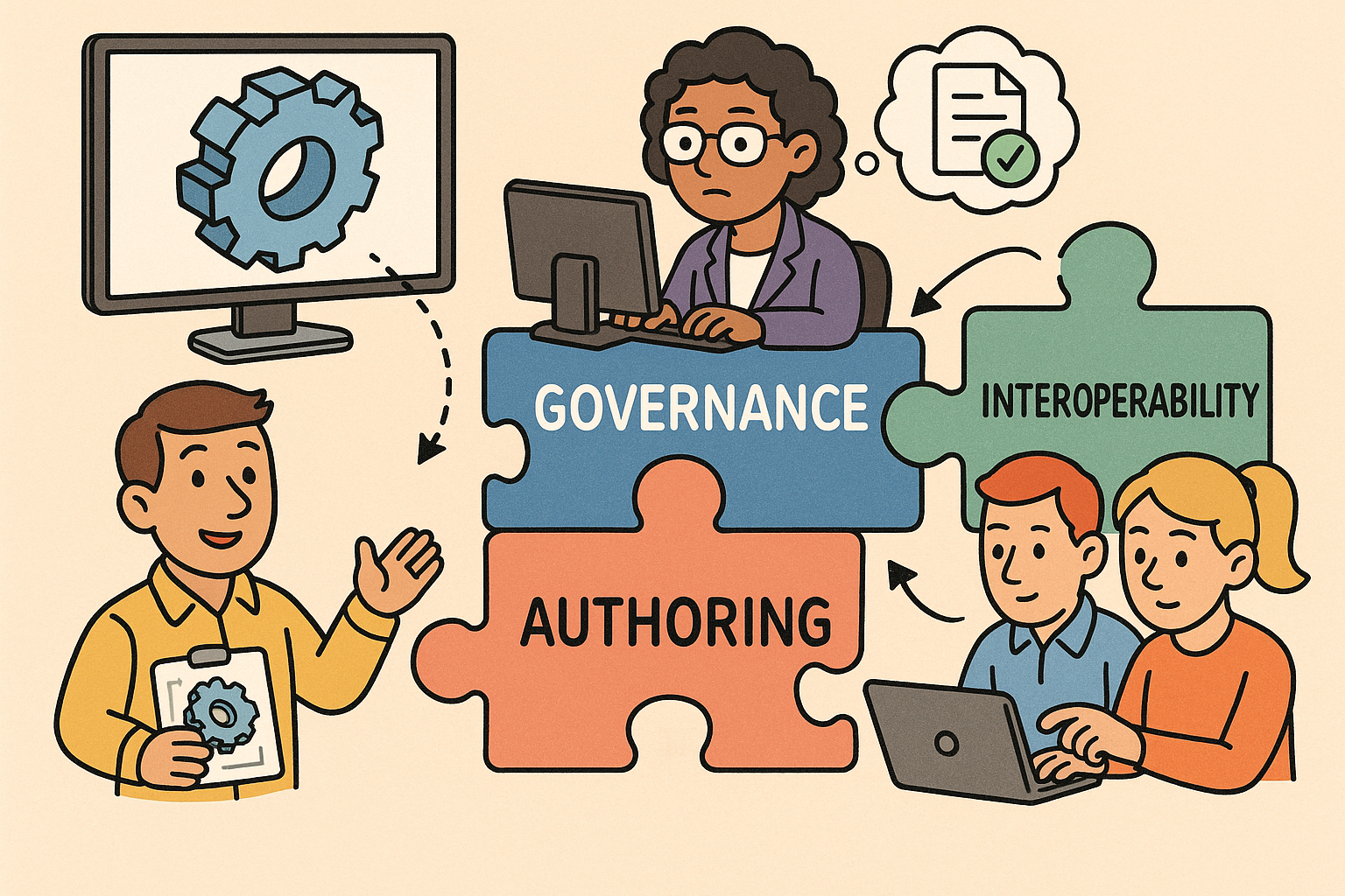
Vendors, tools, and early heritage deployments
Software ecosystems that shaped practice
Commercial and open ecosystems matured in parallel, each answering different needs across budgets, team sizes, and regulatory environments. Agisoft’s PhotoScan—now Metashape—made end-to-end photogrammetry accessible with practical defaults and extensibility via Python; Pix4D, spun out of EPFL, focused on mapping/UAV workflows with strong geospatial alignment; and 3Dflow’s 3DF Zephyr targeted engineering and heritage users with flexible licensing. Autodesk’s 123D Catch demystified photogrammetry for the public before consolidating into ReCap Photo and enterprise toolchains, while Bentley’s ContextCapture (born from Acute3D) served infrastructure-scale projects. RealityCapture from Capturing Reality (later acquired by Epic Games) optimized aggressively for speed and completeness, aligning with game-engine pipelines. On the open side, OpenDroneMap enabled community-scale mapping, while AliceVision/Meshroom put a sophisticated pipeline behind an approachable UI. Downstream, MeshLab from ISTI-CNR—stewarded by Paolo Cignoni, Marco Callieri, and Alessandro Scopigno—standardized mesh inspection, measurement, and filters, and CloudCompare provided heavyweight point cloud analysis. For model repair and fabrication readiness, Netfabb popularized automated mesh healing. Together, these tools created a layered ecosystem: fast image-to-mesh engines; QA and repair utilities; and integration bridges to GIS, CAD/BIM, and visualization—allowing heritage teams to assemble fit-for-purpose toolchains without reinventing core algorithms every project.
Institutions and programs
Institutional leadership stabilized experimentation into repeatable practice. CyArk, co-founded by Ben Kacyra, demonstrated how LiDAR and photogrammetry could complement each other for heritage-scale documentation and risk mitigation, and the Scottish Ten (Historic Environment Scotland with CyArk) set the tone for rigorous, multi-sensor capture. Conservation bodies such as the Getty Conservation Institute, ICCROM, UNESCO’s World Heritage Centre, Historic England, and national museums—the Smithsonian Digitization Program Office, The British Museum, and The Metropolitan Museum of Art—built capacity around digital capture, publishing guidelines and fostering communities of practice. A crucial backbone emerged in the form of Arches, the heritage inventory and management platform developed by the Getty Conservation Institute and the World Monuments Fund. By treating 3D models as linked assets rather than standalone deliverables, Arches brought metadata, provenance, and spatial context together under governance frameworks that cultural institutions require. In this environment, photogrammetry moved beyond a series of experiments to become a durable component of conservation strategy, cataloging workflows, and public engagement, with curators and conservators increasingly co-authoring technical specifications alongside imaging specialists and surveyors.
Hardware shifts that enabled velocity and scale
Commodity hardware did as much as algorithms to propel adoption. High-resolution DSLR and mirrorless systems from Canon, Nikon, and Sony—with fast, fixed prime lenses or calibrated zooms—yielded crisp, low-noise imagery at modest budgets. UAV platforms from DJI extended coverage to façades, roofs, and landscapes, especially once RTK bases and smart targets tightened exterior orientation robustness. Lightweight mast rigs plugged gaps where drones were impractical, and improved shutter synchronization and rolling-shutter compensation reduced artifacts in dynamic environments. Hybrid capture became standard: terrestrial laser scanners from Leica Geosystems, FARO, and Trimble delivered completeness and reliable surfaces for occlusion fill, while camera rigs supplied texture fidelity and fine detail; more recently, mobile LiDAR in devices like the iPad Pro added quick-and-dirty geometry for planning, site notes, and interior occlusions. These combinations let teams balance field time, safety constraints, and accuracy requirements. The principle was pragmatic: capture more than you think you need, at multiple scales, with redundancy for failure points; then let software reconcile the heterogeneous streams into a coherent, auditable whole ready for analysis, interpretation, and storytelling.
Representative early-use patterns
As methods stabilized, recognizable use patterns emerged across heritage sectors. Stone façades and masonry walls were captured for orthophoto elevations supporting conservation drawings, where true-scale imagery helped trace joints, pointing, and differential weathering. Small artifacts—ceramics, statuary, relief fragments—were scanned with turntable rigs and color-managed workflows to produce consistent textures and scale-accurate geometry suitable for measurement and publication. Rapid, low-intrusion documentation supported at-risk sites, enabling emergency stabilization planning and interim protection, while double-use pipelines produced public-facing interactives that extended access beyond the site boundary. Across these patterns, teams converged on a few common practices: controlled overlap, stable lighting, and physically referenced color; thorough metadata capture; and downstream alignment to collections information systems. The deliverables were not merely visualizations but evidence-bearing records, able to inform interventions and to be reprocessed as algorithms improved, maintaining a living chain of custody from lens to archive to viewer.
Workflow integration: from field to HBIM, analysis, and public dissemination
Field-to-mesh pipeline
Integration begins with disciplined capture planning. Projects define overlap targets, baseline-to-distance ratios, and parallax budgets that match site geometry: corridors and cloisters ask for tighter spacing and varied look angles; open courts and towers benefit from longer baselines. Lighting management matters as much as coverage; planning around solar position, using reflectors or diffusion, and employing RTI where low-relief details demand raking light reduce both noise and post-processing effort. In processing, teams move predictably: image alignment and sparse reconstruction; bundle adjustment with outlier culling; dense cloud generation; meshing and hole filling; decimation and smoothing; and texture baking geared to the final platform’s constraints. Throughout, QA is not an afterthought but a continuous loop. Practitioners cross-check RMSE of control, track per-image and per-cluster reprojection error, compare measured scale bars against model distances, and compute GSD estimates to set expectations about measurable limits. When the workflow is consistently documented—lens settings, calibration results, target inventories, algorithm versions—the resulting mesh is portable through time: future teams can interpret, re-validate, or re-derive without guessing how the geometry was produced.
Into CAD/BIM and analysis
The value of a mesh amplifies when it aligns with GIS and informs design tools. Georegistration to published coordinate reference systems (EPSG) ensures that models overlay with survey layers in QGIS or Esri ArcGIS, linking imagery and geometry to parcels, utilities, and hazard maps. In building-focused projects, HBIM authoring relies on importing E57 or LAS point clouds and OBJ/PLY meshes into Revit or Archicad via ReCap or ContextCapture, then reverse-modeling masonry, timber, and vault geometries into parametric families. Research by Maurice Murphy, Eugene McGovern, and Sara Pavia demonstrates that HBIM benefits when semantics encode historic fabric, construction logic, and uncertainty, rather than flattening everything to generic walls and slabs. Analytical workflows flow from there: temporal photogrammetry supports deformation monitoring, crack and efflorescence mapping align to grids for change detection, and simplified, watertight surrogates feed FEA/CFD in ANSYS, Abaqus, or OpenFOAM. The caution is methodological: triangulated surfaces must be checked for tessellation quality, normal consistency, and watertightness before simulation; where the model is only a photographic shell, the pipeline should clearly flag analytical limits so that visual richness does not masquerade as structural truth.
Interoperability, standards, and preservation
Long-term value depends on interoperable formats, disciplined metadata, and explicit rights management. On the file side, teams keep source images in RAW, archive geometry as OBJ or PLY, emit point clouds in E57 or LAS/LAZ, and distribute for visualization in glTF or USD while acknowledging that STL and 3D PDF (PRC) still serve fabrication and review niches. Metadata travels with the files: EXIF/IPTC fields for capture specifics, links to heritage schemas like CIDOC CRM for semantics, and IIIF manifests for image sets that need interoperable web delivery. Preservation strategies align to OAIS, defining ingest, storage, and dissemination plans that carry forward integrity checks, fixity, and access controls. Rights and ethics are explicit, not implied. Many institutions choose Creative Commons licenses for general-access assets but reserve restrictions for sensitive or sacred sites, and community data sovereignty frameworks ensure that digitization does not strip communities of agency over their heritage. A minimal, repeatable checklist helps operationalize this layer: name the CRS; list control and calibration artifacts; state processing versions; include rights statements; and deposit to repositories that commit to format migration rather than one-time dumps.
Visualization and making it tangible
Public value is realized when models are seen, handled, and reinterpreted. Web and real-time channels—Sketchfab (now part of Epic Games), and pipelines into Unreal Engine or Unity—allow progressively streamed meshes, PBR materials, and annotated narratives to reach browsers and galleries. The ecosystem around Quixel’s Megascans, itself rooted in scan-derived assets, normalized expectations of rich surface detail and consistent material response, which heritage teams increasingly match through calibrated textures and normal maps. In museums, interactive kiosks and AR/VR layers bring scale and context to fragile or inaccessible artifacts; tactile value arrives through 3D-printed replicas for handling programs and prosthetic conservation parts, with Stratasys and Formlabs common on the fabrication side and CNC toolpaths derived from meshes supporting physical reconstruction jigs. To keep these channels maintainable, teams design with platform constraints in mind—polygon budgets, texture atlases, draw-call limits—while retaining a master, high-fidelity asset under preservation governance. The result is a layered dissemination strategy: lightweight models for engagement, high-resolution archives for scholarship, and controlled derivatives for fabrication—each traceable back to the same, well-documented camera and control data.
Conclusion
What changed
Over two decades, a quiet realignment transformed photogrammetry from specialist surveying into a cornerstone of cultural heritage workflows. The catalyst was a confluence: robust, open algorithms for keypoints, matching, and optimization; affordable, well-understood cameras and lenses; and a software ecosystem that balanced open research with competitive commercial engineering. This combination collapsed the cost of entry and redistributed expertise: curators, conservators, and field archaeologists now carry pipelines once limited to national mapping agencies. Meanwhile, LiDAR–photogrammetry fusion matured into a pragmatic norm—laser scanners ensuring completeness and reliable surfaces; cameras delivering detail and texture—so that teams can optimize for accuracy, speed, or budget rather than accept a single compromise. Crucially, the community learned to treat geometry as evidence: bound to control, measured against reprojection error, and embedded in geodesy. That shift—away from “pretty models” toward auditable records—is what made the technology stick, and what now underwrites its role in planning interventions, tracking change, and opening collections to the public without sacrificing rigor.
What we learned
Technical capability is necessary but not sufficient. Without standards and semantics, triangles become stranded assets. The field’s maturation shows that CIDOC/IFC/HBIM alignment matters as much as choice of MVS algorithm. Models acquire value when they link to inventories, condition assessments, and intervention histories; they lose it when stored as unlabeled files on isolated drives. QA must be engineered into the workflow—defining GCP strategy, logging calibration and processing versions, publishing error metrics—so that future teams can trust, compare, and reuse results. Ethics and rights require the same forethought: community consultation, clear licenses, and practical controls prevent well-intentioned digitization from causing harm. The operational lesson is simple: design the pipeline around long-term stewardship and community benefit first, then choose tools and parameters that satisfy those constraints. When that order is respected, innovations in capture or reconstruction add value; when reversed, even a flawless reconstruction can become a maintenance burden or, worse, a barrier to responsible access.
What’s next
New appearance-first representations promise lighter capture and richer rendering. Neural radiance fields (NeRFs), accelerated by Instant-NGP, and Gaussian splatting can deliver view-consistent, photoreal results with minimal rigging and fewer images, while on-device SLAM continues to shrink the gap between scanning and everyday photography. The likely trajectory is not replacement but convergence: hybrid pipelines that fuse neural fields with metrically reliable meshes, packaged for interchange in glTF and USD and previewed in game engines. Expect automated QA to scale: per-epoch change detection at site or district scales, anomaly flags driven by learned priors, and dashboards that summarize control health, reprojection distributions, and color stability. Integration with conservation management platforms—Arches for heritage assets and BIM 360/Autodesk Construction Cloud for projects—will make digitizations actionable rather than static. Finally, the long arc will be social and archival: community-centered practices, capacity building, and sustainable repositories will determine whether today’s captures remain usable in fifty years. In that future, the winning technologies will be those that respect constraints, preserve provenance, and make it easy to pass knowledge forward.
Also in Design News